screenshot taken in FSX..
100% ad-free
![]() by Adrian Brausch » Sun Jul 19, 2009 2:43 am
by Adrian Brausch » Sun Jul 19, 2009 2:43 am

![]() by Adrian Brausch » Sun Jul 19, 2009 3:27 pm
by Adrian Brausch » Sun Jul 19, 2009 3:27 pm
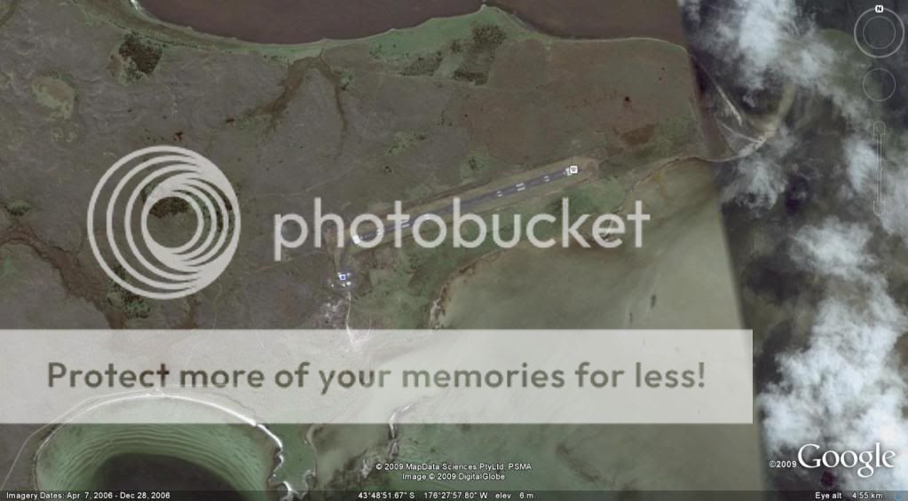
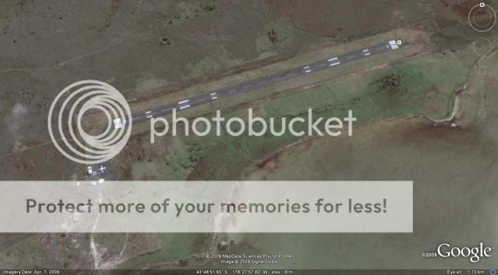
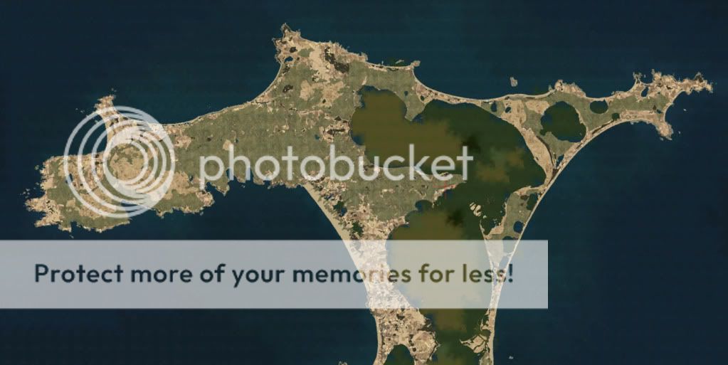
Timmo wrote:QUOTE (Timmo @ Jul 24 2009, 03:23 AM) <{POST_SNAPBACK}>nope don't think it is the Chathams...
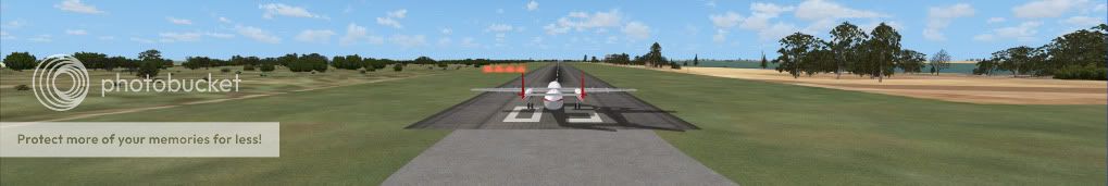
Lol,..it is indeed the Chathams Tim ,.. as I said the default is naaaasty as is why I am hangin for a replacement,...VERY much looking forward to your release !!!! ( good spotting Ian !!)Last edited by Adrian Brausch on Sun Jul 19, 2009 3:28 pm, edited 1 time in total.
![]() by Ian Warren » Sun Jul 19, 2009 11:07 pm
by Ian Warren » Sun Jul 19, 2009 11:07 pm


![]() by dbcunnz » Thu Jul 23, 2009 6:55 pm
by dbcunnz » Thu Jul 23, 2009 6:55 pm


![]() by Adrian Brausch » Thu Jul 23, 2009 11:31 pm
by Adrian Brausch » Thu Jul 23, 2009 11:31 pm
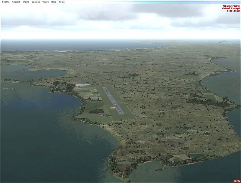
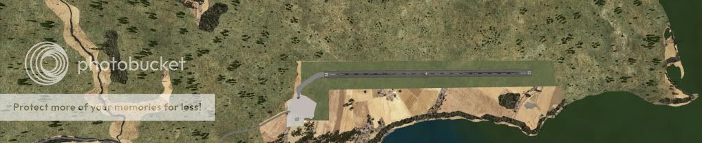
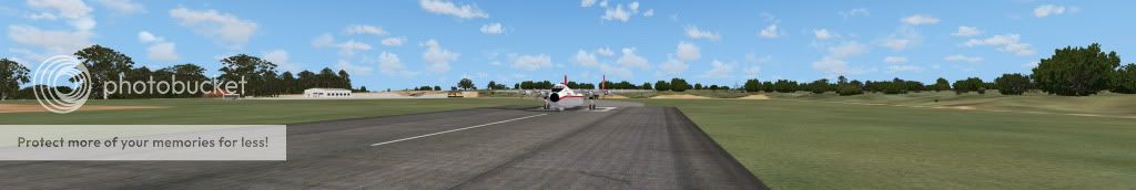
dbcunnz wrote:QUOTE (dbcunnz @ Jul 28 2009, 06:55 AM) <{POST_SNAPBACK}>Pity someone wouldn't get a chainsaw and cut the trees back another 500 meters at both ends of the runway so you could come into land without skimming the top of the trees
yeah man, in reality the area in and around the airport is really barren, ..i tried using FSX planner to put a flatten as well as exclude areas around the airport but nothing seems to work,..any quick fixes you could share along those lines while we wait patiently for your superb mesh replacement Timmo ?Last edited by Adrian Brausch on Fri Jul 24, 2009 3:12 pm, edited 1 time in total.
![]() by Timmo » Sat Jul 25, 2009 3:51 pm
by Timmo » Sat Jul 25, 2009 3:51 pm
![]() by Adrian Brausch » Sun Jul 26, 2009 10:27 pm
by Adrian Brausch » Sun Jul 26, 2009 10:27 pm
Timmo wrote:QUOTE (Timmo @ Jul 30 2009, 03:51 AM) <{POST_SNAPBACK}>For a very quick fix you could download FSXKML- this allows you to digitise a polygon in google Earth and then assign a tag to it in FSXKML and compile into a bgl for flightsim (It allows you to do a heap of other stuff too. Its a very useful freeware tool)
Use a landclass polygon tagged with heath or scrub or similar (a bit of experimentation might be needed)- These landclasses have more realistic autogen annotation.
Thanks Timmo Ill have a crack at choppin down some of them pesky trees at the chathams airport
![]() by dbcunnz » Sun Jul 26, 2009 11:05 pm
by dbcunnz » Sun Jul 26, 2009 11:05 pm
brausch wrote:QUOTE (brausch @ Jul 26 2009, 10:27 PM) <{POST_SNAPBACK}>Thanks Timmo Ill have a crack at choppin down some of them pesky trees at the chathams airport
If you get something worked out to take the timber from each end of the Chathams airport to the mill let me know maybe we can build a few new buildings and a new wharf for the Chatham islanders and make it safe to land there without trimming trees with the prop on landing and take off.
The problem of Forrest at each end of the airport is in FSX scenery as seen by Google there is no Forrest anywhere near the airport.Last edited by dbcunnz on Mon Jul 27, 2009 12:00 am, edited 1 time in total.
![]() by dbcunnz » Tue Jul 28, 2009 12:13 am
by dbcunnz » Tue Jul 28, 2009 12:13 am
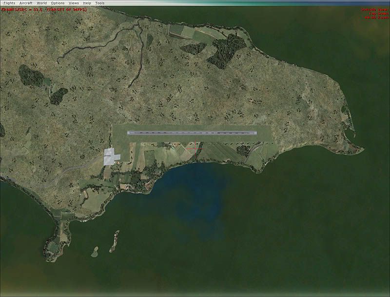
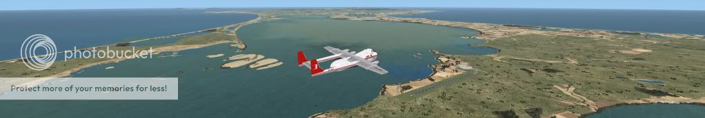
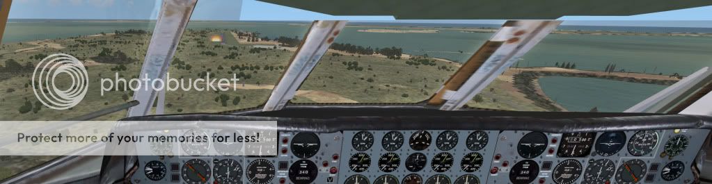
Timmo wrote:QUOTE (Timmo @ Jul 27 2009, 04:57 PM) <{POST_SNAPBACK}>This any better?
(You guys have mail too- May as well get some beta testing done
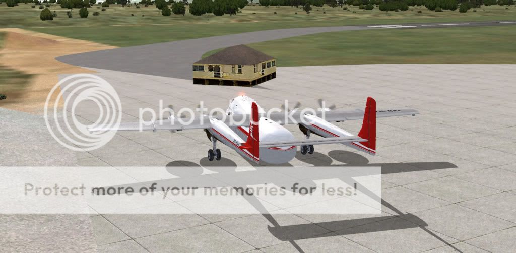
Thanks Timmo this is what I have now some of these are taken over 3 monitors defiantly a big improvement on the default Chathams but still got a brown patch on the East side of the airport.
Have a bit of a problem here I don't know why this building is placed here.
![]() by Ian Warren » Tue Jul 28, 2009 2:43 am
by Ian Warren » Tue Jul 28, 2009 2:43 am
![]() by Adamski » Tue Jul 28, 2009 8:53 pm
by Adamski » Tue Jul 28, 2009 8:53 pm
Timmo wrote:QUOTE (Timmo @ Jul 25 2009, 03:51 PM) <{POST_SNAPBACK}>For a very quick fix you could download FSXKML- this allows you to digitise a polygon in google Earth and then assign a tag to it in FSXKML and compile into a bgl for flightsim (It allows you to do a heap of other stuff too. Its a very useful freeware tool)
Use a landclass polygon tagged with heath or scrub or similar (a bit of experimentation might be needed)- These landclasses have more realistic autogen annotation.
Timmo ... you got me intrigued!
Installed FSXKML (and FWTools). I already had the SDK installed. It successfully created a BGL but it ain't showing
I'm doing a test tile for NZAA and Coromandel - to replace the yukky default stuff inside and around the airport(s). What tag should I be using? Also - what layer priority should it be?
How does FSXKML actually grab the image? Does it connect to Google Earth for it?

![]() by Timmo » Tue Jul 28, 2009 9:32 pm
by Timmo » Tue Jul 28, 2009 9:32 pm
Users browsing this forum: No registered users and 47 guests