Dan's bush tours

Share your simulated flights around NZ here. The place to post your flight reports, flight plan instructions and progress on tours

Postby gojozoom » Tue May 10, 2011 9:11 pm

Hi guys,

I know there were thousands of show-off topics about VLC, but I think, that a very important and pretty amazing feature of it didn't get enough attention just yet.

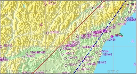
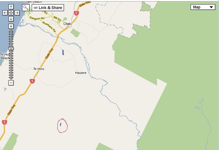
Have a look at this map (wait until the page loads up properly), and you'll see thousands of airstrips around New Zealand. Most of them are in the middle of native bush, or a mountain range with no option for a go-around. Just how I like it. Being a big fan of bush-flying, VLC opened up a huge door for me, as 99% of these airstrips are well defined, and can be spotted easily. In the meantime, aircraft developers came up with some pretty neat STOL aircrafts recently.

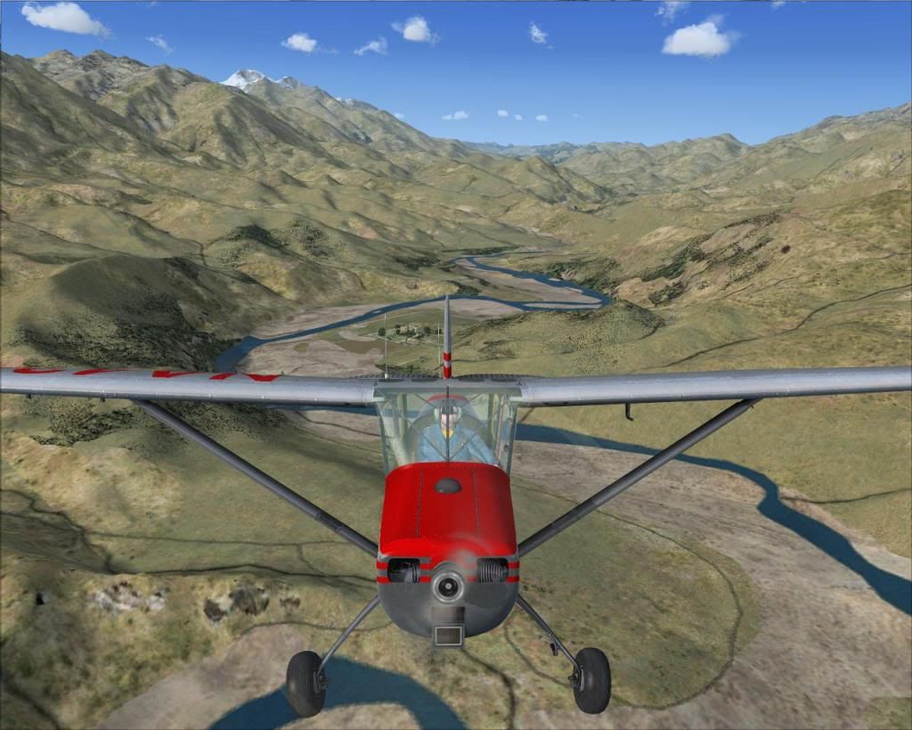
Anyway, since around November, I fly from airstrip to airstrip, my SuperCub hasn't seen any tarmac for quite some time now. I thought I'd share the process of bush-flight planning and some screenshots of the actual flight.

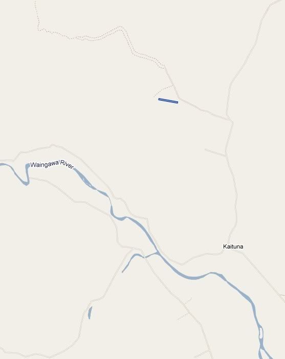
Even before I start FSX, I open that map, and choose an airstrip about 20 minutes away from the last place I landed (in Map mode). I'll take off at Paraparaumu this time, so I chose the Manganoe North Rd strip not too far from Waikanae. :


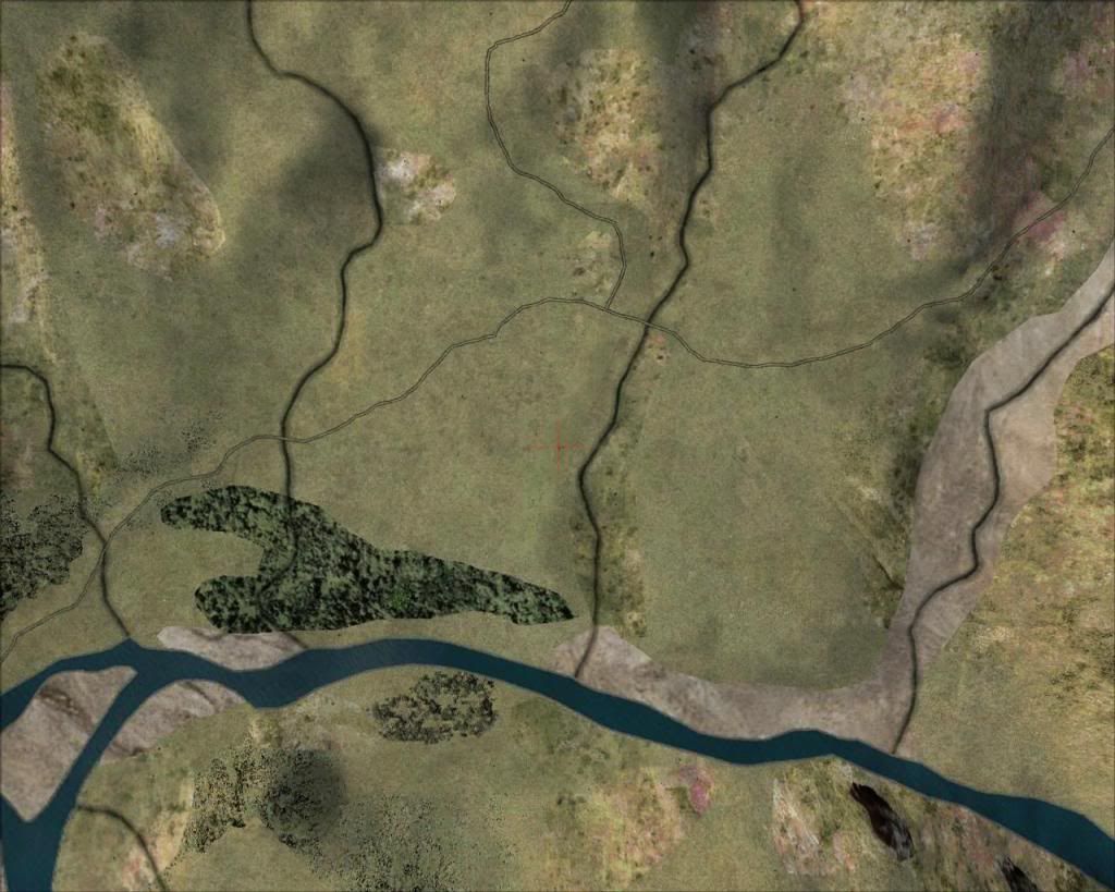
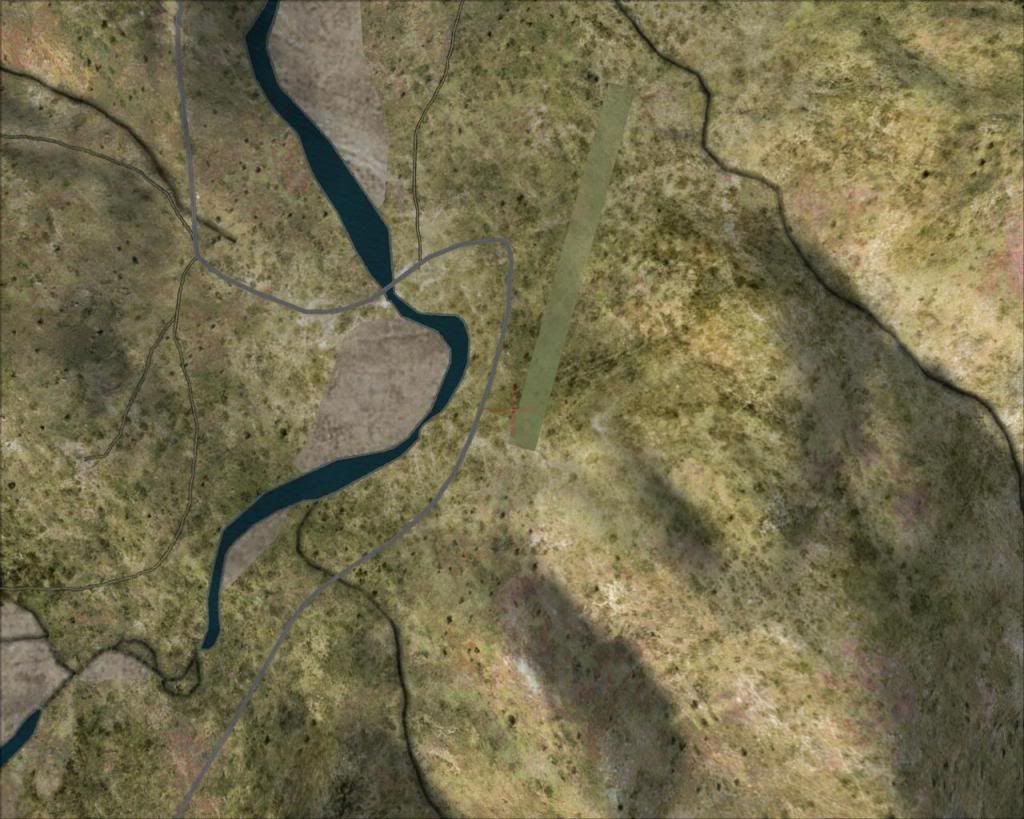
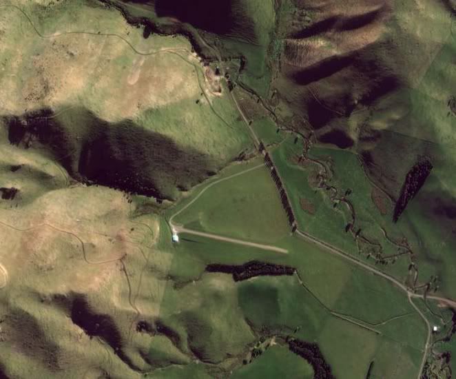
Then I switch to Satellite mode and have a look at the actual strip. In this case it looks like this:


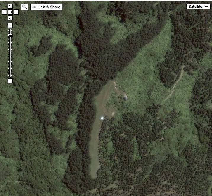
I neat little strip isn't it? And you'll see how perfectly it's replicated in VLC.

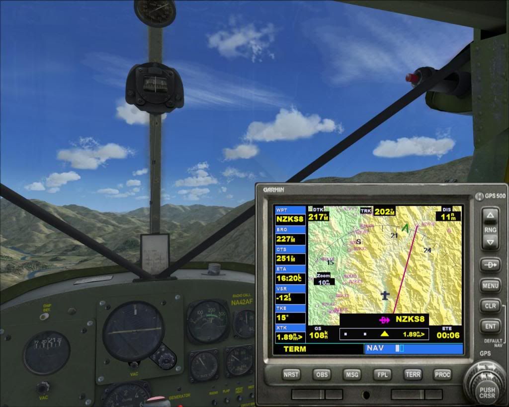
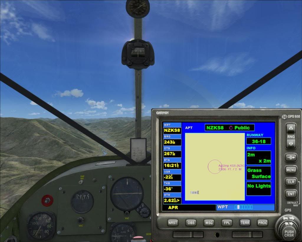
So, the next step is to open Plan-G (the BEST VFR tool to date!) and find the airstrip there. It's not too hard actually. Then I create a new waypoint, and save a new flight plan as a .pln file, so that I can load it up in my GPS on board.

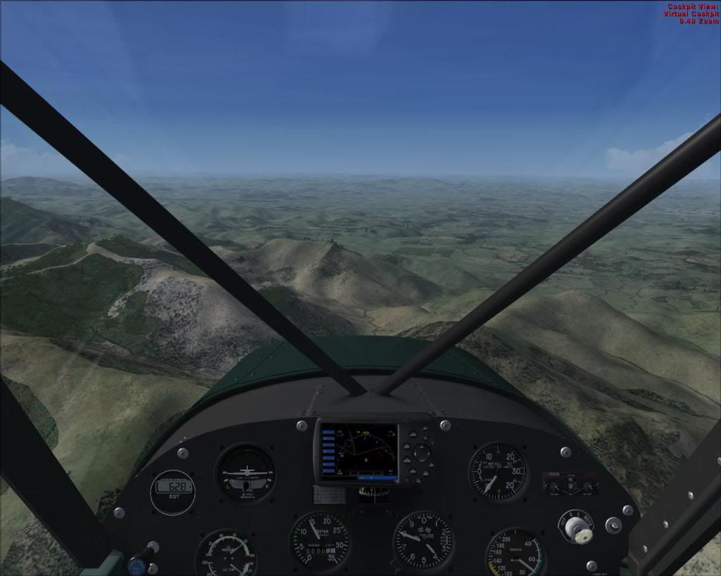
Yes, we are finally ready to fly....wait, I just load real weather quickly. The wind is calm enough, and we only have a few clouds at 4000. All good, let's take off.

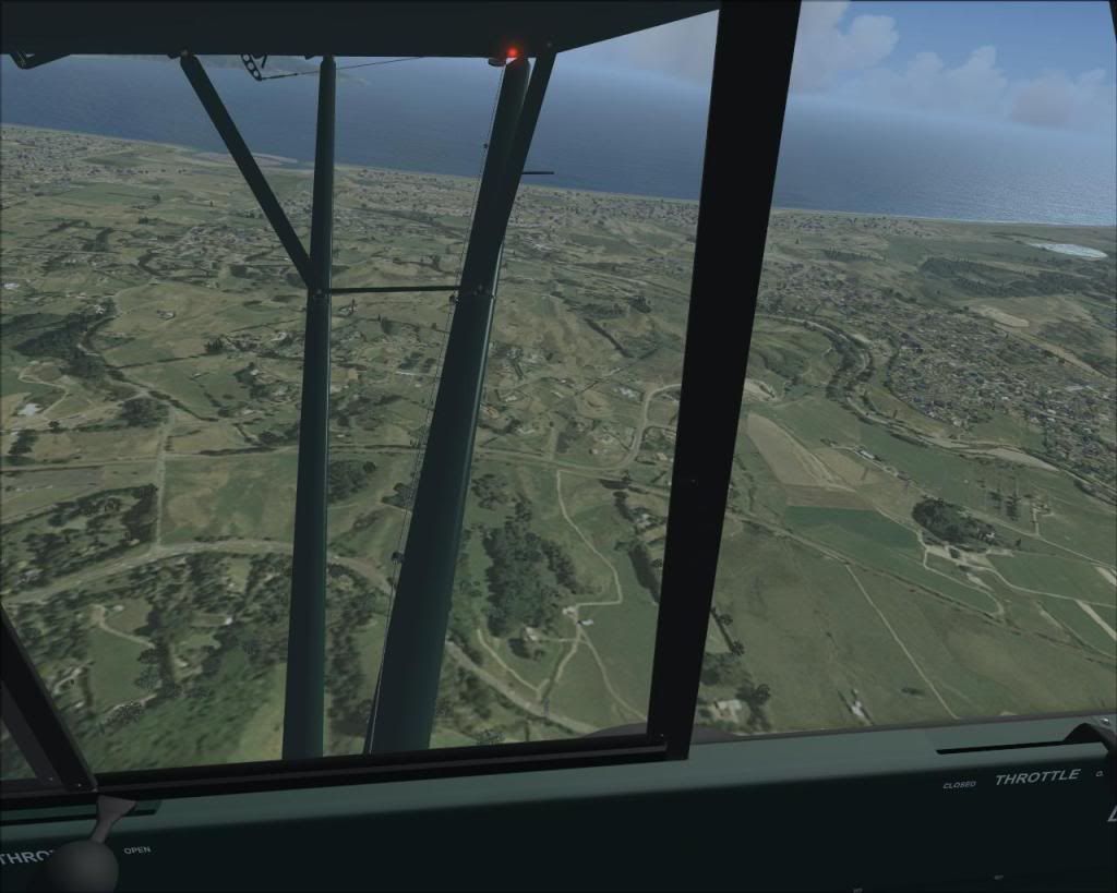
The view after leaving the left-hand circuit in Paraparaumu


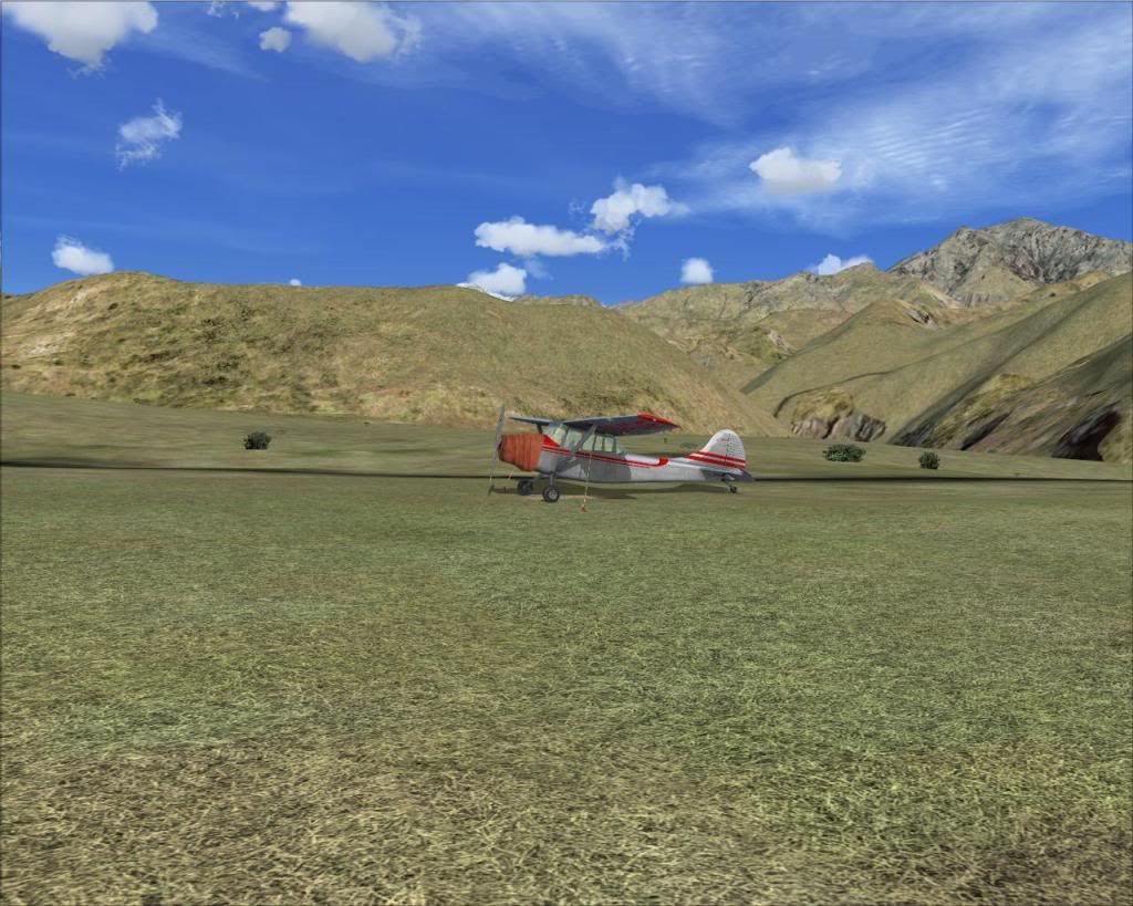
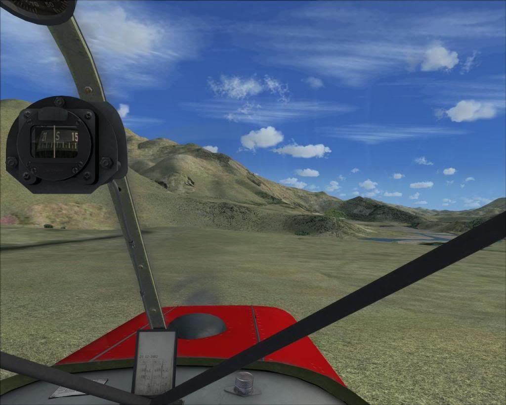
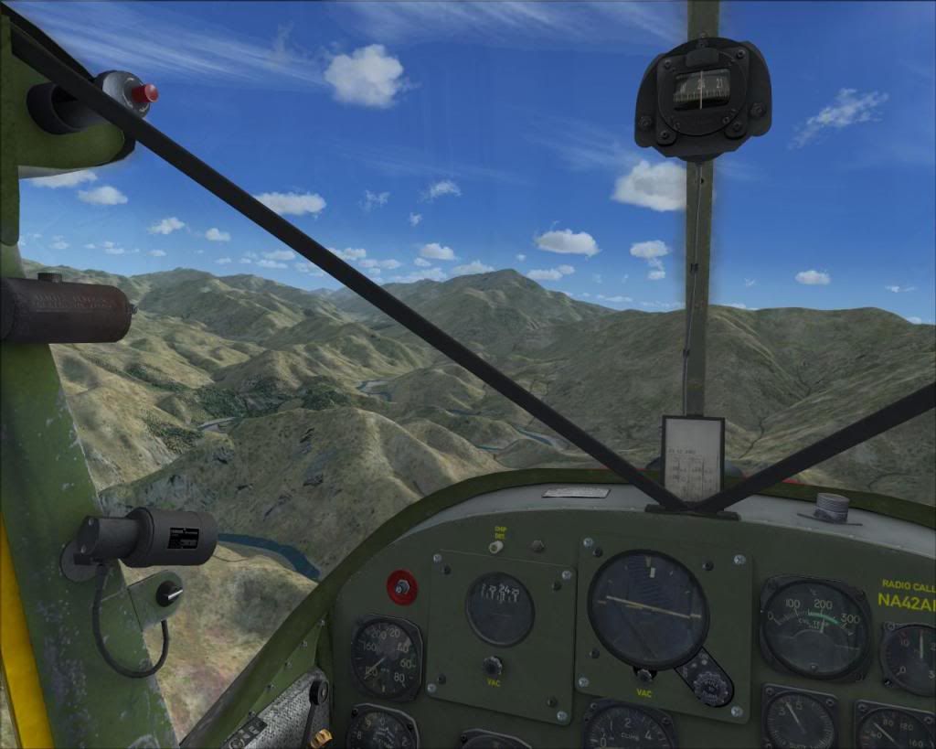
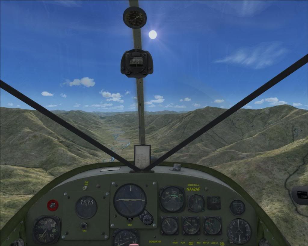
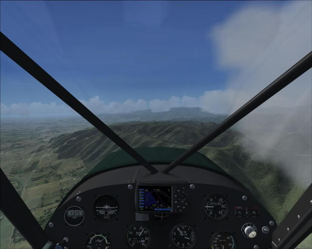
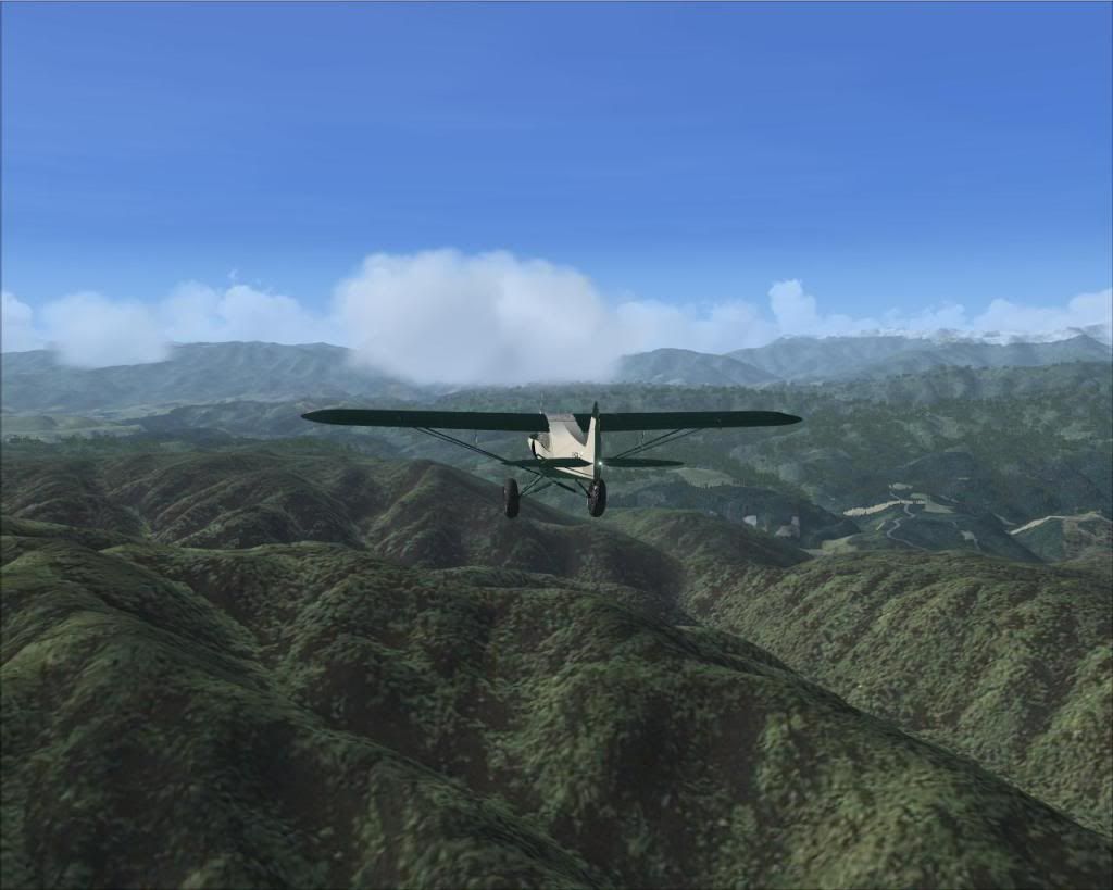
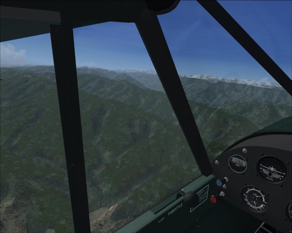
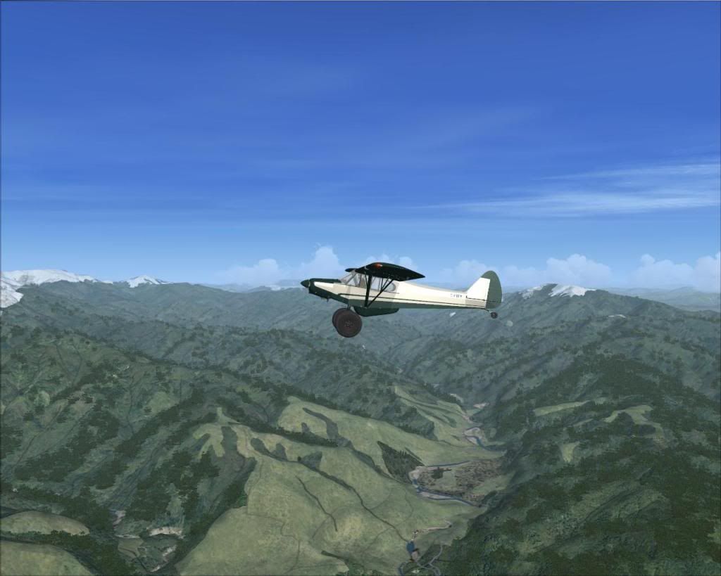
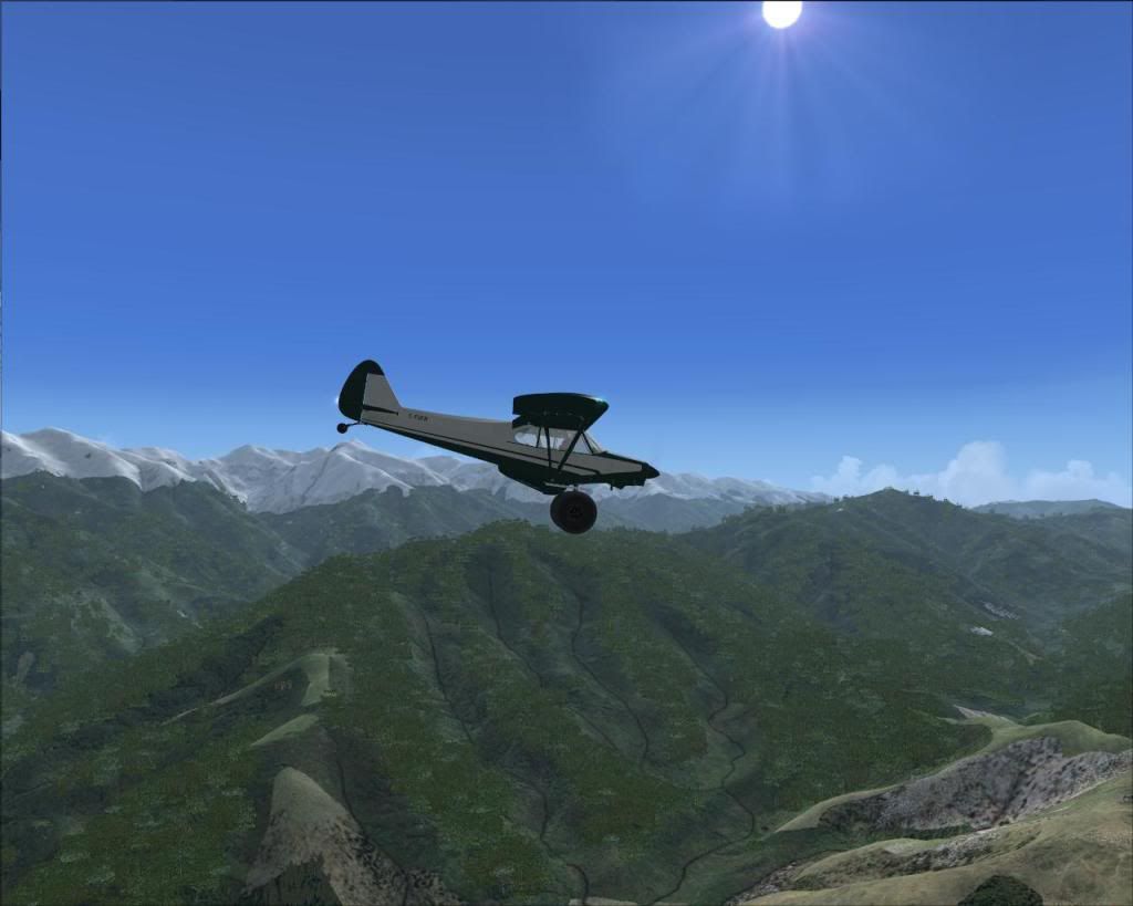
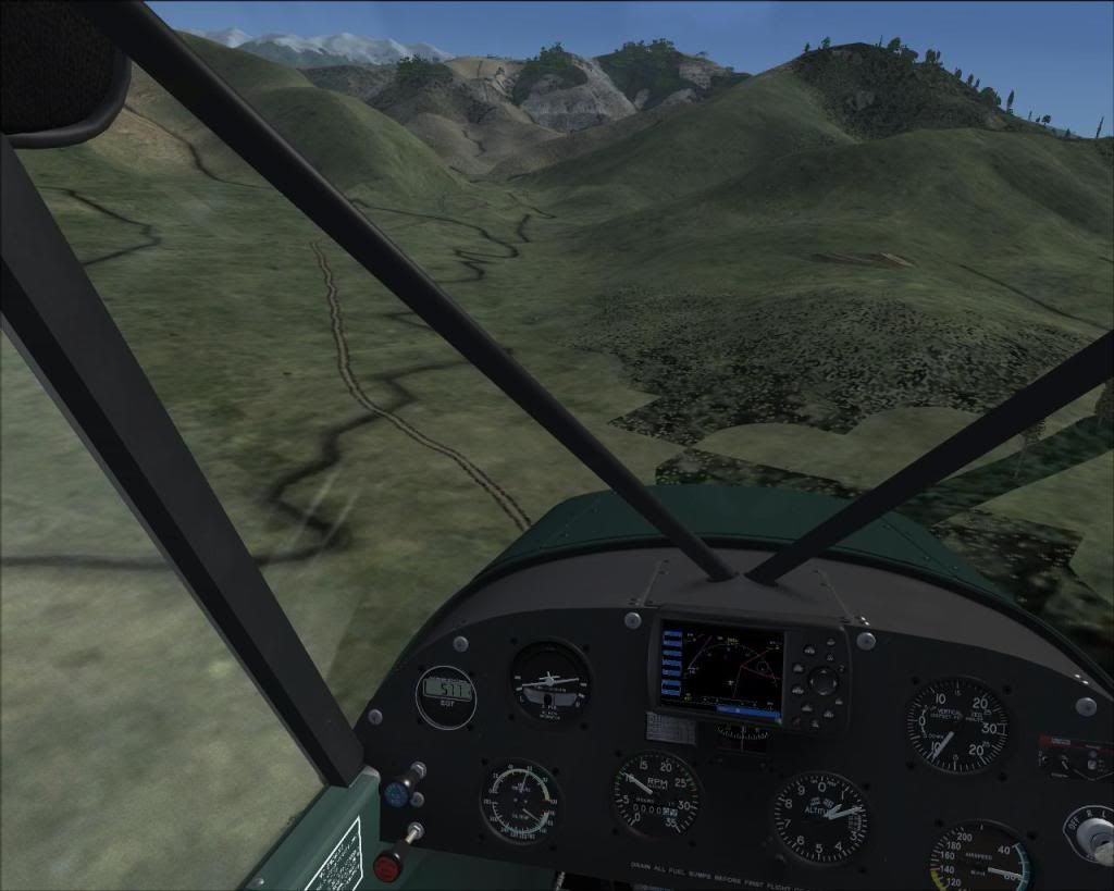
Getting closer to the mountains (that's when I start smiling)


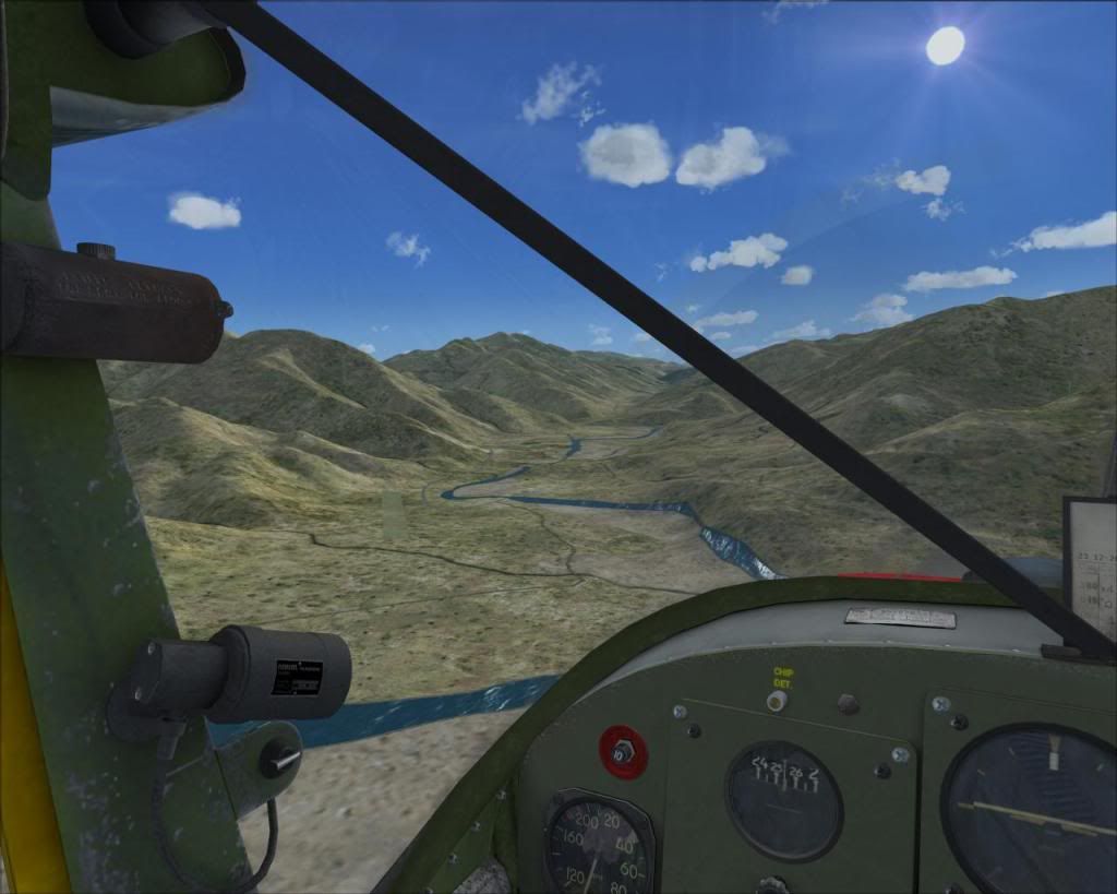
Just enjoying the scenery (RealNZ Wellington)


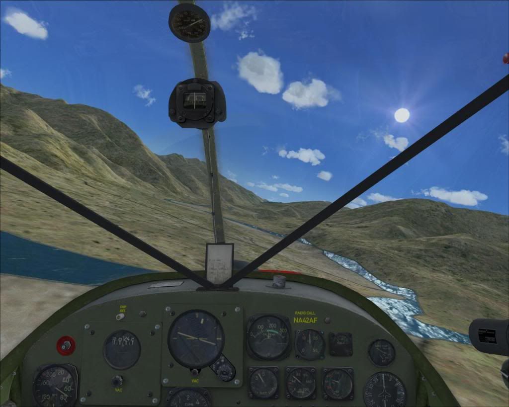
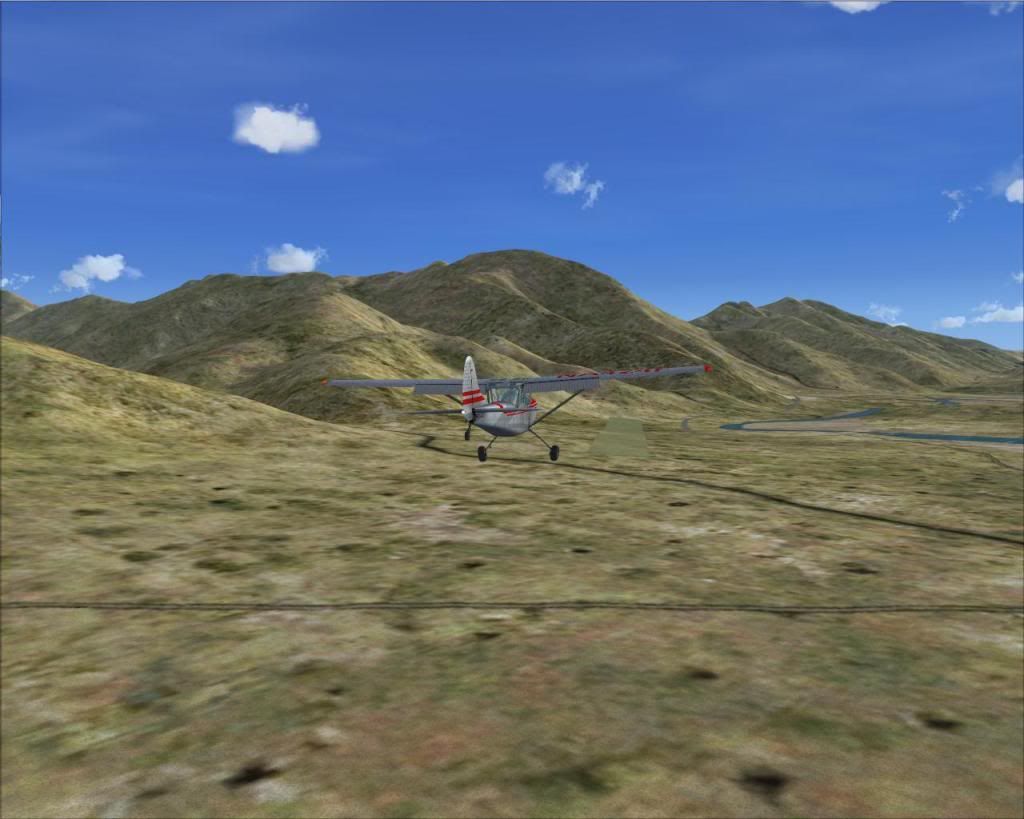
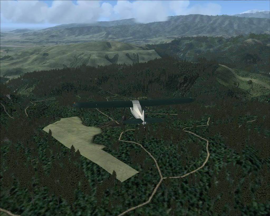
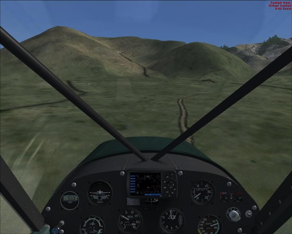
...and here is our strip in VLC. Just compare it's shape with the one on the satellite image....it's just amazing!


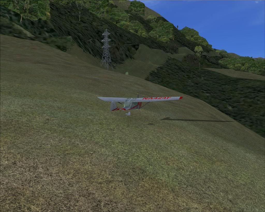
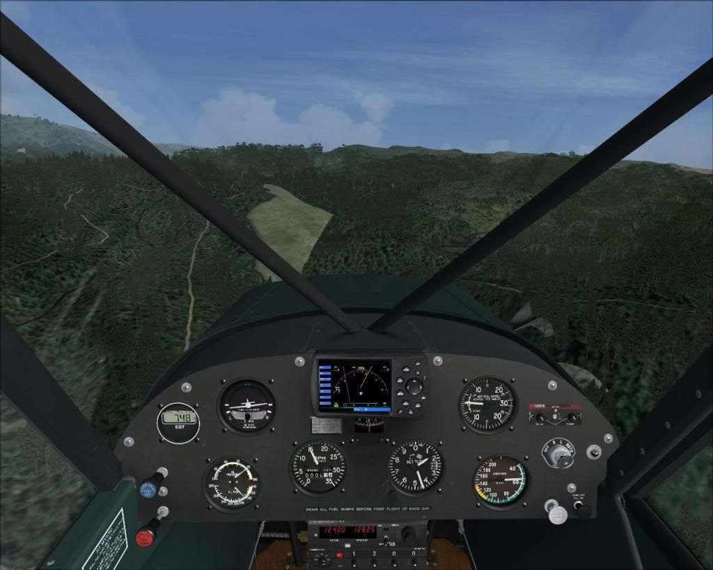
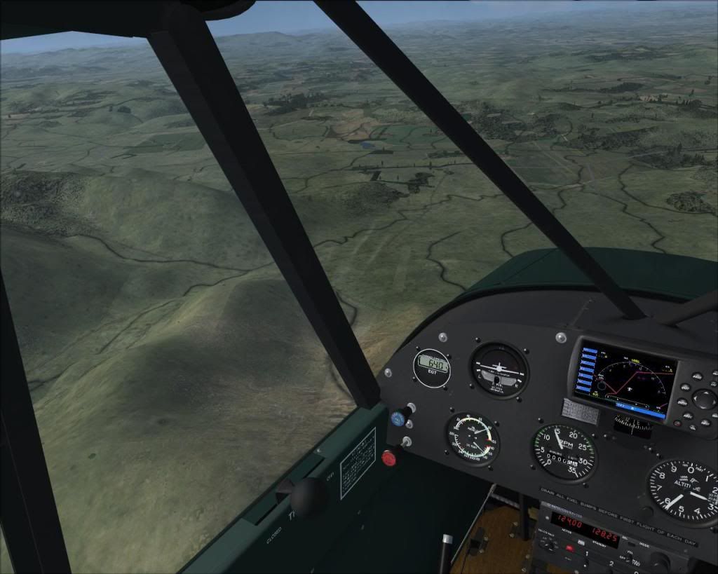
After a fly-over check, I found it safe enough...I'm on the final here


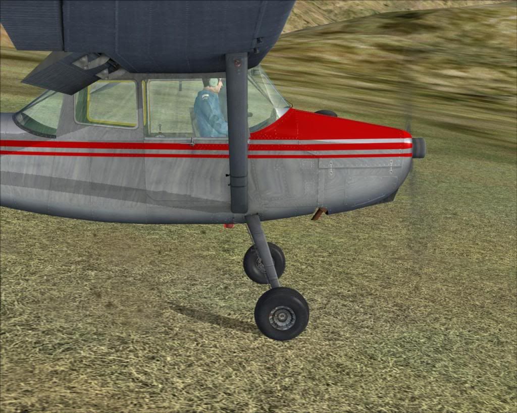
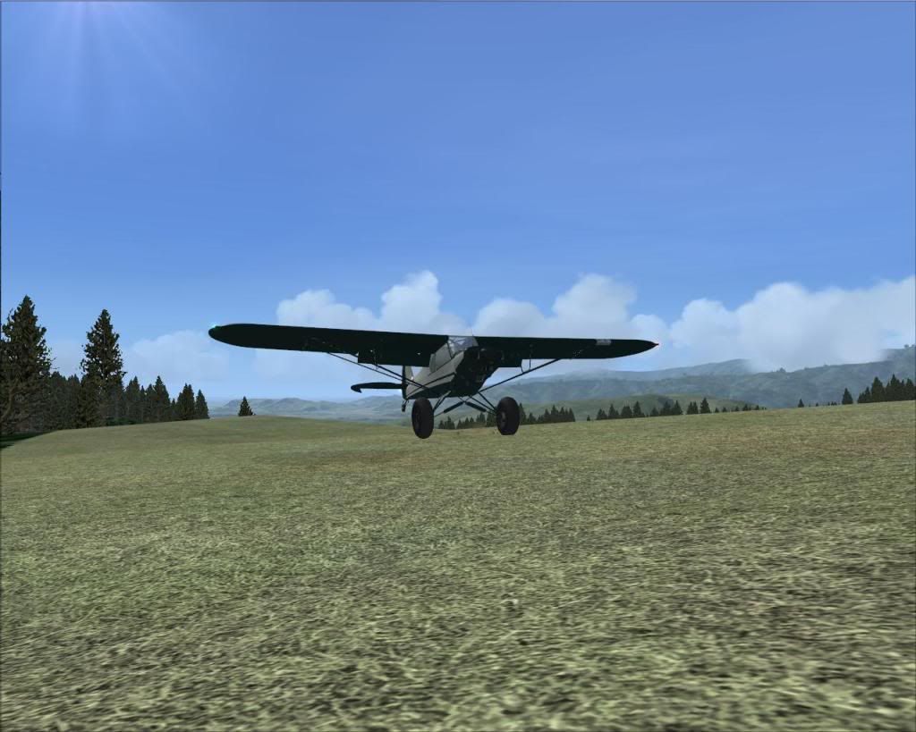
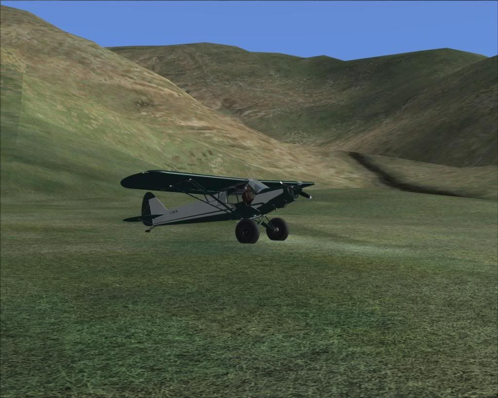
The moment of touchdown


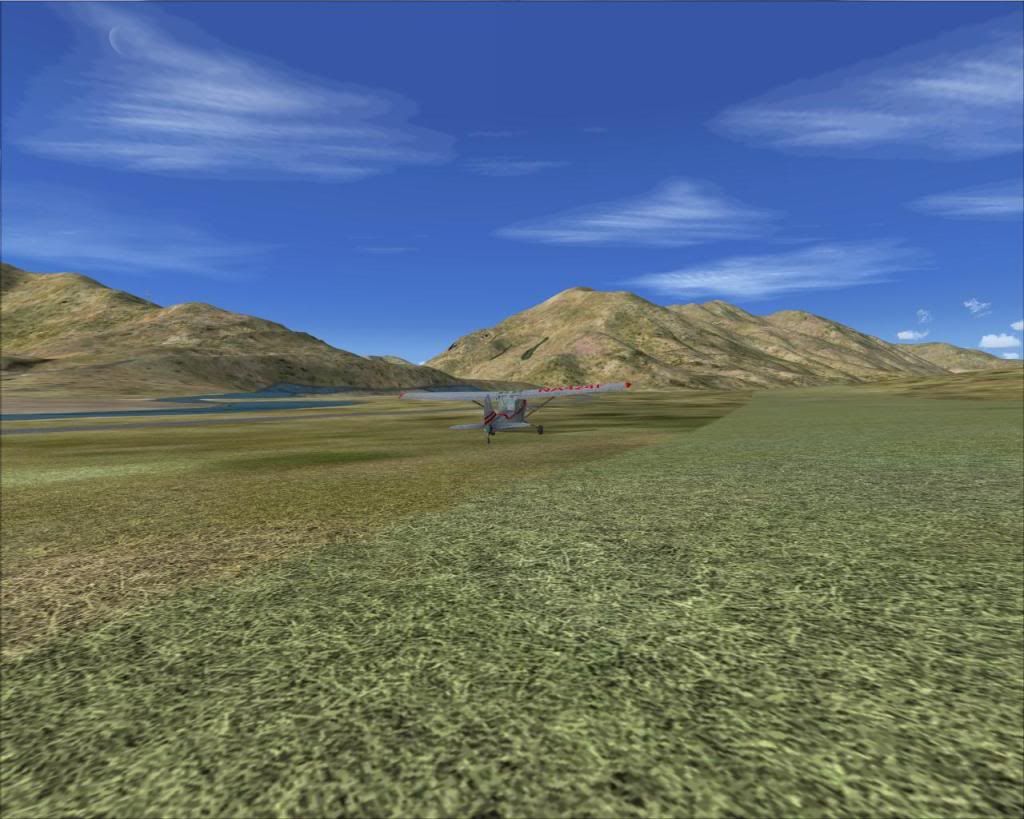
And here I am in the middle of nowhere...Terrific!


...TO BE CONTINUED....
Image
User avatar
gojozoom
Sim-holic
 
Topic author
Joined: Fri Dec 21, 2007 10:37 am
Posts: 947
Location: Wellington

Postby gojozoom » Tue May 10, 2011 9:26 pm

I just realized that I submitted the same post twice, so I removed one.
Last edited by gojozoom on Tue May 10, 2011 9:59 pm, edited 1 time in total.
Image
User avatar
gojozoom
Sim-holic
 
Topic author
Joined: Fri Dec 21, 2007 10:37 am
Posts: 947
Location: Wellington

Postby gojozoom » Tue May 10, 2011 9:26 pm

The next flight took me from the Mangaone North Rd strip to the other side of Tararua. I followed the exact same process as in the previous post. I chose the Black Creek Rd strip on the koordinates map:


Than I had a look at the satellite image. Again, watch out for the details (the two hills, and the roads next to it)...you'll be amazed by VLC once again.


I'm all set, GPS turned on, let's fly.

Climbing out


Showcasing VLC


It's time to descend


Can you see it?


On approach... see the roads and the creek? Just like on the satellite image.


Now, let's get a beer


I hope I could raise your motivation about those low-and-slow birds a bit....


Dan
Last edited by gojozoom on Tue May 10, 2011 9:58 pm, edited 1 time in total.
Image
User avatar
gojozoom
Sim-holic
 
Topic author
Joined: Fri Dec 21, 2007 10:37 am
Posts: 947
Location: Wellington

Postby J7G » Tue May 10, 2011 9:50 pm

Great post mate. Makes me want to get VLC...maybe soon if I can get a good helicopter to hoon around Welly in.

That first one is interesting. It reminds me of an airfield near there I'd seen on the map in the Mangatukutukus IIRC. I always meant to go up to check it out but never got there.

EDIT: Actually it looks like the same one but it's clearly not in the Mangatukutuks.
Last edited by J7G on Tue May 10, 2011 9:51 pm, edited 1 time in total.
User avatar
J7G
Forum Addict
 
Joined: Wed Feb 23, 2011 8:49 pm
Posts: 449

Postby Ian Warren » Tue May 10, 2011 9:52 pm

Dan , you would easy get a B17 into there biggrin.gif ..ok we will stick with the Huey for the time being smile.gif
Image
User avatar
Ian Warren
NZFF Pro
 
Joined: Fri May 05, 2006 5:23 pm
Posts: 41187
Location: AREA 51

Postby J7G » Tue May 10, 2011 9:59 pm

I must say that that is a most excellent link. Although it shows a supposed airfield near Eastbourne which seems to be nothing at all. Otherwise excellent.
User avatar
J7G
Forum Addict
 
Joined: Wed Feb 23, 2011 8:49 pm
Posts: 449

Postby gojozoom » Tue May 10, 2011 10:25 pm

J7G wrote:
QUOTE (J7G @ May 10 2011,9:59 PM) <{POST_SNAPBACK}>
I must say that that is a most excellent link. Although it shows a supposed airfield near Eastbourne which seems to be nothing at all. Otherwise excellent.


When I had a look at the area I live, I found a strip on a nearby mountain. I thought it was just a bug, but guess what, I found it when I had a walk around there. I was told by a local, that it was used for some agricultural work until about 95', but it's not used anymore. And it's there in VLC too...of course...
Last edited by gojozoom on Tue May 10, 2011 10:26 pm, edited 1 time in total.
Image
User avatar
gojozoom
Sim-holic
 
Topic author
Joined: Fri Dec 21, 2007 10:37 am
Posts: 947
Location: Wellington

Postby J7G » Tue May 10, 2011 10:29 pm

That's a good point. I was looking for some out near the Southern Crossing since I'm planning to tramp it in a few weeks but nothing unfortunately.
User avatar
J7G
Forum Addict
 
Joined: Wed Feb 23, 2011 8:49 pm
Posts: 449

Postby Timmo » Wed May 11, 2011 2:43 am

Great set of screens Dan- VLC really is great not just for flying over the terrain but actually getting down amongst it and exploring this beautiful country of ours! Keep us posted of your progress!
Timmo
NZFF Pro
 
Joined: Wed Oct 25, 2006 6:28 pm
Posts: 2056
Location: Tauranga

Postby Naki » Wed May 11, 2011 8:46 am

Great thread & pics...the Super Cub also looks good..also a reminder that I must try Plan G
Last edited by Naki on Wed May 11, 2011 9:48 am, edited 1 time in total.
User avatar
Naki
NZFF Pro
 
Joined: Sat Aug 05, 2006 10:03 pm
Posts: 7170
Location: Tauranga

Postby ZK-LGD » Wed May 11, 2011 9:46 am

Thanks for the link, Dan; that's one very valuable tool indeed. Many of these strips also show up in FS9, especially when using Christian's Topo; Kordinates just helps locate them more easily. Thanks.
Regards,
Dorian
User avatar
ZK-LGD
Sim-holic
 
Joined: Fri Apr 28, 2006 3:34 pm
Posts: 742
Location: Springfield, Canterbury

Postby cowpatz » Wed May 11, 2011 11:05 am

Great find Dan. Thanks for sharing this.
Remember the 50-50-90 rule. Anytime you have a 50-50 chance of getting something right, there's a 90% probability you'll get it wrong!

Image
User avatar
cowpatz
NZFF Pro
 
Joined: Wed Mar 07, 2007 3:28 pm
Posts: 3739

Postby Ian Warren » Wed May 11, 2011 12:42 pm

I got one better than Daniels Cub , The Harrier laugh.gif
Image
User avatar
Ian Warren
NZFF Pro
 
Joined: Fri May 05, 2006 5:23 pm
Posts: 41187
Location: AREA 51

Postby gojozoom » Wed May 11, 2011 2:47 pm

Ian Warren wrote:
QUOTE (Ian Warren @ May 11 2011,12:42 PM) <{POST_SNAPBACK}>
I got one better than Daniels Cub , The Harrier laugh.gif


By the way, I will switch plane for the next trip, to make it even more challenging. I'll borrow the Caravan from Air2There. They won't be too happy about it...neither the passengers, who think that they'll be taken to Nelson...
Image
User avatar
gojozoom
Sim-holic
 
Topic author
Joined: Fri Dec 21, 2007 10:37 am
Posts: 947
Location: Wellington

Postby spongebob206 » Wed May 11, 2011 3:45 pm

Impressive

Thanks mate
Image
spongebob206
Senior Member
 
Joined: Thu Jan 10, 2008 6:04 pm
Posts: 1526
Location: Wanganui

Postby Ian Warren » Wed May 11, 2011 4:16 pm

gojozoom wrote:
QUOTE (gojozoom @ May 11 2011,3:47 PM) <{POST_SNAPBACK}>
They won't be too happy about it...neither the passengers, who think that they'll be taken to Nelson...

Wait till each one is told to open the fence gates .. excuse me .. oh sorry .. excuse me .. whoops biggrin.gif
Last edited by Ian Warren on Wed May 11, 2011 4:17 pm, edited 1 time in total.
Image
User avatar
Ian Warren
NZFF Pro
 
Joined: Fri May 05, 2006 5:23 pm
Posts: 41187
Location: AREA 51

Postby ScottyB » Fri Jul 22, 2011 4:34 am

Loving this Dan!

So how many of the airstrips that are seen on the map here, are replicated in VLC? Surely not all of them!

Thanks and keep it up!
Scotty
Image
User avatar
ScottyB
Sim-holic
 
Joined: Thu Aug 30, 2007 3:58 pm
Posts: 571
Location: New Zealand

Postby gojozoom » Fri Jul 22, 2011 10:40 am

I did quite a lot of flights since first my post (I was just too lazy to load them up here), and I couldn't find a missing airstrip so far. I'll keep looking smile.gif
Image
User avatar
gojozoom
Sim-holic
 
Topic author
Joined: Fri Dec 21, 2007 10:37 am
Posts: 947
Location: Wellington

Postby Timmo » Fri Jul 22, 2011 12:45 pm

ScottyB wrote:
QUOTE (ScottyB @ Jul 22 2011,4:34 AM) <{POST_SNAPBACK}>
Loving this Dan!

So how many of the airstrips that are seen on the map here, are replicated in VLC? Surely not all of them!

Thanks and keep it up!
Scotty


Yep all of them are there:) Plus, the cool thing about the accuracy of VLC is that even if an airstrip isn't in the data, if there is a clearing, say in bush, then there should be a clearing in FSX too...you just might have to contend with shrubs and bushes instead of grass winkyy.gif
Timmo
NZFF Pro
 
Joined: Wed Oct 25, 2006 6:28 pm
Posts: 2056
Location: Tauranga

Postby gojozoom » Tue Feb 28, 2012 5:18 pm

Hi everyone,

After almost a year, I finally found the time to fly again, and complete some more bush adventures. This time it's a bit different though. It's more "adhoc", more "let's see what happens" kind of adventure. Thanks to Timmo, I don't have to spend all that time finding those airstrips on satellite images and align them in Plan-G, 'cos they are all "pre-loaded" in FSX for me. So simply load up the FSX flight planner and choose a departure strip and a destination from there, keeping the terrain in mind. I chose a random strip, and had a look around to find an ideal candidate as a destination. Well, I love flying in valleys, and found one up the valley only 28 miles away to the north. The picture below shows 3 things:

1.) 30+ airstrips in the area
2.) The direct route
3.) The river and the valley I'll be flying through


The package contains 2 bgl files (one for each island), that will load all those remote VLC airstrips into your flight planner and on-board GPS. You just have to copy the files into your VLC scenery folder.

Well, let's load up the flight then. My favorite bush plane -at the moment- is the Sibwings Bird Dog (latest version includes a lot of paints -even a native NZ one-, the ski and the float versions):


PLEASE NOTE : Some airstrips don't work too well as a starting point (picture taken of my previous flight):


Now back to our flight. FSX loaded the aircraft right in the middle of the strip, that is pretty convenient:


I wisely decided to take off down-hill (no sh*t Sherlock), however, that hill on the other side of the river seemed to be waaay too close:


Who cares - I thought - this old Cessna climbs like chopper.... And it did.

On my way through the valley:


Following a straight line at FL200? Booorrring! Follow the river at 500AGL instead:)


Some handy elevation info about our little strip:


What a gorgeous valley!


When I'm about 5 miles from the strip I just descend to the strip elevation + 1000 feet, so that I can fly a circle above it, check the headings and plan my way in.
This is what you see here:


On the final after flying a full circle:


And a pretty smooth landing:


Now...let's grab that fishing equipment, and a six pack:


CONCLUSION

Timmo's GPS data is of huge value for the ones interested in bush flying using VLC. No more endless searching and cross-referencing with the maps. Finally I can start a flight on a remote strip without flying (or slewing) there from a bigger airport. I can fly 4-5 short hops withing 30 minutes (due to the density of the airstrips), giving me more opportunities to practice and having more fun within that short time period.

Possible future developments:

- Integration with Plan-G (according to Timmo this is pretty easy to do)
- Using the real world airstrip names in the location field

Simply awesome work! Thank you Timmo!

Dan
Last edited by gojozoom on Tue Feb 28, 2012 8:00 pm, edited 1 time in total.
Image
User avatar
gojozoom
Sim-holic
 
Topic author
Joined: Fri Dec 21, 2007 10:37 am
Posts: 947
Location: Wellington


Return to Flights

Who is online

Users browsing this forum: No registered users and 7 guests