-Robin Corn, Admin
@'antdavison'
from my own fs2004-4.8m photo-realistic build of nz, have about 70% country wide aerial photo coverage, 30% satellite coverage
Very impressive work. Well done.

100% ad-free
![]() by scaber » Tue Jan 25, 2011 7:44 pm
by scaber » Tue Jan 25, 2011 7:44 pm


![]() by antdavison » Tue Jan 25, 2011 8:28 pm
by antdavison » Tue Jan 25, 2011 8:28 pm
scaber wrote:QUOTE (scaber @ Jan 25 2011, 08:44 PM) <{POST_SNAPBACK}>@'antdavison'
from my own fs2004-4.8m photo-realistic build of nz, have about 70% country wide aerial photo coverage, 30% satellite coverage
Very impressive work. Well done.
thanx scaber, it was a bit of a labour of love
data set is about 330,000 pixels square (@ 4.8m/pixel), colour balanced so different aerial data sets merge seamlessly with one another, entire country covered, no flying into computer generated terrain, all cloud cover removed, some area's are from pre-2000 black and white linz photos, but have recoloured them using colours taken from satellite data, have a bunch of new datasets which i will composite over this one over the next few months, to further reduce area's covered only by satellite data
also have the same data with a linz topo overlay, ie roads, beaches, hilltop spot heights, etc marked with monochrome text, not so realistic, but at least you know where you are, and how high the nearest hill is :-)

![]() by Ian Warren » Tue Jan 25, 2011 9:08 pm
by Ian Warren » Tue Jan 25, 2011 9:08 pm


![]() by antdavison » Tue Jan 25, 2011 9:41 pm
by antdavison » Tue Jan 25, 2011 9:41 pm
Ian Warren wrote:QUOTE (Ian Warren @ Jan 25 2011, 10:08 PM) <{POST_SNAPBACK}>Ant D , how many small area coverages , small towns example , only covering the main roads in and out but in-compass the layout off each town in a effort to cut splice and build onto VLC , autogen to suit and snap ,perfect urban small town .
not sure i fully understand your question ... do you want some data of a generic small town, along a state highway somewhere ... i have the whole country as one dataset
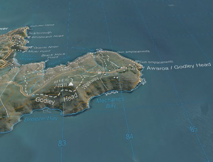
sample zoom to lyttleton ... banks penninsula, and lake area to the south in this version is recolourized black and white aerial
http://s1195.photobucket.com/albums/aa393/...ttletonZoom.mp4
with topo overlay from nasa worlwind, this topo overlay is in colour, in the fs version i knocked back the colour to monochrome, so it isn't as garrish
fs dataset is a port from this one, my mesh in this program in not great, especially around the coast, hence the hilly sea
http://i1195.photobucket.com/albums/aa393/...worldwind01.jpg
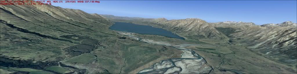
from memory, this was also colourized from black and white
http://i1195.photobucket.com/albums/aa393/...n/fs2004-02.jpg
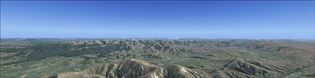
probably satellite only data
http://i1195.photobucket.com/albums/aa393/...n/fs2004-03.jpg
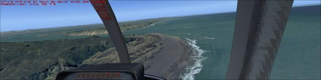
west coast beaches of auckland ... i left all the sea detail in, rather than cutting a mask for fs sea
http://i1195.photobucket.com/albums/aa393/...n/fs2004-01.jpgLast edited by antdavison on Tue Jan 25, 2011 9:43 pm, edited 1 time in total.
![]() by Ian Warren » Tue Jan 25, 2011 10:10 pm
by Ian Warren » Tue Jan 25, 2011 10:10 pm
Users browsing this forum: No registered users and 9 guests
