Loved how the weather was accurate! rubbish out of Rotorua and lovely in Wellington apart from the wind


100% ad-free
![]() by Dash8captain » Mon Jan 04, 2021 4:24 pm
by Dash8captain » Mon Jan 04, 2021 4:24 pm
![]() by Splitpin » Mon Jan 04, 2021 5:39 pm
by Splitpin » Mon Jan 04, 2021 5:39 pm
 Every screen a winner, and the last one is the perfect end ...detail detail. Charl will love it , he has a thing about the landing gear.
![]() by Dash8captain » Mon Jan 04, 2021 6:57 pm
by Dash8captain » Mon Jan 04, 2021 6:57 pm
Splitpin wrote:Holy cow young fella you've outdone yourself this time ... the first shot made my eyes water
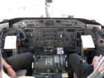
Is that a default aircraft Dash?
![]() by Splitpin » Mon Jan 04, 2021 7:02 pm
by Splitpin » Mon Jan 04, 2021 7:02 pm
![]() by Charl » Mon Jan 04, 2021 9:25 pm
by Charl » Mon Jan 04, 2021 9:25 pm

![]() by Aharon » Tue Jan 05, 2021 6:34 am
by Aharon » Tue Jan 05, 2021 6:34 am
![]() by Dash8captain » Tue Jan 05, 2021 11:53 am
by Dash8captain » Tue Jan 05, 2021 11:53 am
Charl wrote:True enough on the LG front, but it's the nacelles in the Dash8 shots taking my fancy!
Very interesting to see the rendition of the Waikanae Estuary in shot 9 - I am assuming this is MSFS? very accurate.
Aharon wrote:AMAZING cloud details!!
What airport is that in the ninth screenshot and what town is that in the passenger wing view screenshot?
Regards,
Aharon
![]() by Radar88 » Tue Jan 05, 2021 2:18 pm
by Radar88 » Tue Jan 05, 2021 2:18 pm
Dash8captain wrote:Charl wrote:True enough on the LG front, but it's the nacelles in the Dash8 shots taking my fancy!
Very interesting to see the rendition of the Waikanae Estuary in shot 9 - I am assuming this is MSFS? very accurate.
Cheers Charl! Yeah it is MSFSAharon wrote:AMAZING cloud details!!
What airport is that in the ninth screenshot and what town is that in the passenger wing view screenshot?
Regards,
Aharon
Airport in ninth shot is Kapiti/Paraparaumu and wingshot is Lower hutt area
![]() by Aharon » Tue Jan 05, 2021 2:51 pm
by Aharon » Tue Jan 05, 2021 2:51 pm
Dash8captain wrote:Airport in ninth shot is Kapiti/Paraparaumu and wingshot is Lower hutt area
Radar88 wrote: Correct with some further side notes.
Screenshot 9: shows Kapiti Island and the Kapiti Coast Airport or formally Paraparaumu Airport NZPP with circa 2015, Bing Map Satellite Imagery data representation of the Paraparaumu Beach and Waikanae River mouth estuary area with a still under construction State Highway 1 Kapiti Coast expressway, seen in a state of half portion completed running along the bottom of screenshot which was eventually fully completed in 2017 and been in active motor vehicle use for the past 3 years.
Screenshot 11: passenger Left window winglet banked turn view showing the Cannons Creek Suburb of Porirua East with Porirua City seen on the right of the State Highway 1 Porirua Interchange.
Screenshot 12: passenger Left window winglet view out shows the Hutt Valley Suburb of Petone looking out towards Seaview industrial area along the Petone foreshore of Wellington Harbour on approach to Wellington NZWN
Screenshot 14: On approach to Wellington NZWN passenger Right window winglet view looking out across towards the West Wind, wind farm turbines spread along the Mākara, coastal hills west of Wellington with the top of the South Island seen looking out off into the distance. This off in the distance area is also known as The Sounds.
Users browsing this forum: No registered users and 27 guests