Back to Blighty

Share your simulated flights around NZ here. The place to post your flight reports, flight plan instructions and progress on tours

Postby G-HEVN » Thu Nov 08, 2007 11:07 am

Leg 22: San Pedro/La Mesa, Honduras (MHLM) to Tuxtla Gutiérrez/Francisco Sarabia, Mexixo (MMTG)
325nm, 2.4 hours (total: 12,335nm, 76.1 hours)

Well, Eaglesoft's spiffy new Twinkie has finally reached FSX, and the default texture features 'chromalusion' - supposedly the first commercial addon to do it. (if you don't know, that's the magic colour-changing paint they use on pimped-up cars). Yes folks, welcome to leg 1 of "Pimp My Plane"! laugh.gif

San Pedro can hold us for only so long, and so we must press on into Mexico. Like everyone else, we've seen pictures of the flooding on TV, but our route stays in the mountains to the South of the affected region, so we're not anticipating any trouble. Anyhow this plane is so pimped up, it probably has a switch somewhere to activate floats!


Although we're planning on a VFR flight, the airport is currently IFR, forcing us to file an IFR flight plan, which hopefully will take us the first few hundred feet, and, sure enough, within seconds we break through the top of the fog layer into bright sunshine. "Tower, cancel IFR!"


You can see how thin the fog layer is, when much of the city is poking through!


Away from the city, and in a leisurely cruise climb. This baby purrs!


Do you notice that if you take kids in the plane, they don't care about this miracle of flight - all they want to do is watch videos!


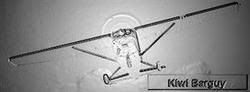
It's hard to show the chromalusion ™ effect in a still picture. Hey kids, this is Guatemala: We're not stopping. Kids? Kids? Oh, never mind!


We're over the Chiapas Highlands, and into the wide Cuilco river valley, where we can start our descent


Somewhere around here is the airport...


Ah, here it is!


Way to go:
G-HEVN
 

Postby Naki » Thu Nov 08, 2007 11:20 am

Nice shots Tim - the Twin Comanche sure looks nice - what are your thoughts on it?
User avatar
Naki
NZFF Pro
 
Joined: Sat Aug 05, 2006 10:03 pm
Posts: 7170
Location: Tauranga

Postby G-HEVN » Thu Nov 08, 2007 11:41 am

I've been looking for ages for a light twin to sub for the DF Baron in FSX, and so far, this looks like being the bird. It's a delight to fly, speedy (160kts). I'm still getting the hang of the panel - haven't yet figured out how to get a standard DME display, and the lack of an ADF is a drawback. It's much smaller than the Baron, and only 4 seats (the Aztec is a closer fit to the Baron), but at 10000ft you can lean it down to 6.5GPH per engine, for a range of 1000nm!

I started this tour in a JF Seneca (horrid plane), I may well finish it in the ES Comanche... smile.gif
G-HEVN
 

Postby kiwibarguy » Fri Nov 09, 2007 10:03 am

Awesome shots G-HEVN!!!
You definitely have your flight specs set up well!
Do you have an add-on for your clouds as they look great!
I am enjoying your journey. keep up the great work! biggrin.gif
Image
User avatar
kiwibarguy
Sim-holic
 
Joined: Fri Sep 21, 2007 1:50 pm
Posts: 629
Location: Auckland

Postby G-HEVN » Sat Nov 10, 2007 11:12 pm

I normally use Active Sky and X Graphics set to 'wx-influenced', but this trip was default online weather and whatever cloud set was last loaded. smile.gif
G-HEVN
 

Postby G-HEVN » Tue Nov 20, 2007 9:40 am

Leg 23: Tuxtla Gutiérrez/Francisco Sarabia (MMTG) to Mexico City/ Lic Benito Juarez Intl (MMMX)
380nm, 2.9 hours (total: 12,715nm, 79 hours)


Even though we've been flying in the mountains for a while now, we're going right up into the mountains this time - to Mexico City, elevation 7,312ft. Aye Carumba!


Funny isn't it, how the GA apron is always at the far end of the airport from the active runway - by the time I'd taxied around and lined up, I could have been halfway there!


Sometimes you just don't want to see out of the window!


Turning on to track


The sea on either side remins us we're flying along an isthmus


The low cloud over the mountains looks almost volcanic


Climbing out of veracruz into the Sierra Madre oriental mountains


Getting close now. On our right are the volcanic peaks of Iztaccíhuatl and Popocatépetl(17,343ft and 17,887ft respectively). This latter is the highest peak in the country, with a crater half a mile across and 1657ft deep!


Approach takes us in over the city


Mexico City airport. We're dwarfed by the heavies at the main terminal as we taxi to the GA apron at the far side of the airport. Again!
G-HEVN
 

Postby G-HEVN » Tue Nov 27, 2007 12:26 pm

Leg 24: Mexico City/ Lic Benito Juarez Intl (MMMX) to Chihuahua/ gen. Div. P.A. Roberto Ferro
672nm, 4.9 hours (total: 13,387nm, 83.9 hours)

Mexico City is big. It's not just the 8.8 million inhabitants, or the sheer size, or the incessant din of stationary traffic, or even the altitude, or even the bureaucracy, but put them all together... The good news it the paperwork has arrived for our crossing into the U.S. $27.50 has got us a decal to stick on the side of the plane, indicating that we've, er, paid $27.50! (mind you the Mexican permit was $50!). The good news is that these permits are valid for a year; the bad news is the year ends in December.


An early start, but the formalities at the airport held us up by several hours. The morning mist showed no sign of lifting, and we ended up having to file IFR, causing even more delay when control claimed they hadn't received the plans. It was after lunch by the time we taxied out.


It didn't take long to climb above the mist, and before too long we were at our filed 12000ft altitude.


Wave action over the mountains made for a bumpy ride, and before long we requested an increase to 14000ft, where the air was smoother. Alhough not pressurised, we had portable oxygen, enough to complete the entire journey.


As the sun started to go down, the mist once again formed below us


Hold on... "As the sun started to go down?" When was my last night landing? Was it less than 90 days ago? Oh well, so long as nobody asks!


Moon above; mist below


Nicely down the ILS, and cleared to land


A long leg, taking us over the Sierra Madre Occidental, and into the Rio Grande Basin. The difference in density of airfields across the border is quite evident from the map!
G-HEVN
 

Postby ardypilot » Tue Nov 27, 2007 1:05 pm

Love the fourth shot down and the new paint job! Keep up the good work mate :thumbup:
User avatar
ardypilot
NZFF Pro
 
Joined: Wed Apr 26, 2006 10:01 am
Posts: 6802
Location: Auckland

Postby G-HEVN » Tue Dec 04, 2007 11:16 am

Leg 25: Chihuahua / General Roberto Ferro Villalobos Intl (MMCU) to Tucson Intl (KTUS)
330nm, 2.9 hours (total: 13,717nm, 86.8 hours)

Our last few days in Mexico have been spent touring the estates of Pancho Villa, legendary figure of the Mexican revolution. For all the world, you'd believe you were on a Wild West movie set! Chihuahua is also the starting point for the Chihuahua al Pacífico railroad - a 400 mile, line stretching through the mountains and the Copper Canyon to the Pacific coast, taking some 16 hours. The canyon, which rivals the US Grand Canyon, the railroad, and in fact any roads at all, are completely missing from FS (maybe they'll be in the much vaunted train sim...)


So now the fun is done, and we taxy out to the active. Before Takeoff checks include double-checking the paperwork - that's something you really don't want to arrive in the US without. Tower confirms our flight plan is active (again, ditto as above), and we're off.


It's a hot day today, and the climb out is slow. for most of the journey to 12,500 ft, we can barely exceed 200fpm!


Finally we're at our cruise altitude.


The Sierra Madre Occidental mountains are our constant companions for this trip


We've crossed the border, and, hey, the American desert looks just like the Mexican desert, but with roads!


We're cleared to land on runway 11L


Tower - or someone - is watching us on approach


Short final. Then a message comes through: A follow me truck will lead us to the GA apron, where we are to remain inside the aircraft, with the door closed, until instructed by the officials who will come out to meed the plane...

G-HEVN
 

Postby ardypilot » Wed Dec 05, 2007 12:08 am

The news today from the MRC Aviation page reminded me of your tour:
Noted at Ardmore and a very long way from its Cornwall, UK based was Piper PA32R-301T Saratoga N515SC. The aircraft departed the UK back on 26Apr on an around the world journey and arrived at Kerikeri from Norfolk Island 03Dec. From Kerikeri to Ardmore and then to North Shore/Dairy Flat 04Dec. The owners inform me they will still be in NZ for Christmas.
User avatar
ardypilot
NZFF Pro
 
Joined: Wed Apr 26, 2006 10:01 am
Posts: 6802
Location: Auckland

Postby G-HEVN » Wed Dec 05, 2007 12:24 am

Everybody's doing it! :lol:
G-HEVN
 

Postby G-HEVN » Mon Dec 10, 2007 12:18 pm

Leg 26: Tucson Intl (KTUS) to McClellan-Palomar KCRQ
325 nm, 2.7 hours (total: 14,042 nm, 89.5 hours)


There's something about a welcome from a man in rubber gloves that makes you not want to hang around. And so after a day or so's discomfort, I resolved to be out of here. The preflight was interesting - not so much a walk around as a careful waddle. But eventually I eased into the left seat and taxied out to the runway.


It started well enough, with some slight haze, and a broken cloud layer at around 5000. We could just push through the gaps and fly on top


I'd like to show you lots of pictures of interesting terrain, but frankly the top of one cloud looks like the top of any other.


Then a gap opened in the clouds below us, and we spotted.... a golf course!


After a couple of hours, we can see the line of the mountains ahead of us. One last hurdle, and then it's San Diago and the sea!


The weather must be improving slightly - the ground is starting to poke through the tops of the clouds. Just like Spring!


Then, suddenly after hundreds of miles of desert... civilisation!


It's hard to do a burn and turn in a Comanche, and anyhow, this is not Miramar, so a simple circuit will have to suffice. :rolleyes:


Final to land.


Da route:
G-HEVN
 

Postby ardypilot » Mon Dec 10, 2007 12:35 pm

Great screenies there- what photoreal is that for the KCRQ area?
Last edited by ardypilot on Mon Dec 10, 2007 12:36 pm, edited 1 time in total.
User avatar
ardypilot
NZFF Pro
 
Joined: Wed Apr 26, 2006 10:01 am
Posts: 6802
Location: Auckland

Postby G-HEVN » Mon Dec 10, 2007 10:08 pm

That's Megascenery SoCal. :)
G-HEVN
 

Postby G-HEVN » Mon Dec 24, 2007 9:53 am

Leg 27: McClellan-Palomar KCRQ to Grand Canyon KGCN
351 nm, 2.9 hours (total: 14,393 nm, 92.3 hours)


Climbing out. It's been a pleasant stay, split between sea fishing and watching the FJs out of Miramar. Now, how does the Top Gun theme go again?


Turning out over the coast before heading inland onto track. Broken cloud at low level is going to make for an interesting trip over the mountains.


These clouds truly are made of granite! A touch more 'up', I think...


Clear skies above an overcast layer, with the occasional hill poking through


And so we head out into the desert. Rich, my wingman is in a Marchetti, and can't resist the urge to play around!


<cough!>


The sun sinks as we reach the Grand canyon, but there's still time for a few 'capers' before it gets dark. lets see just how well we can remember those canyon turns!


No matter how far down you go, just when you think you've reached the bottom, there's an even deeper canyon...


It's getting dark now, and so we must climb back up to 7000ft for our approach into the airport!

G-HEVN
 

Postby G-HEVN » Sun Dec 30, 2007 12:41 pm

Leg 28: Grand Canyon National Park KGCN to Van Nuys KVNY
329 nm, 2.9 hours (total: 14,722 nm, 95.2 hours)

I may not be getting any closer to my ultimate destination (in fact this leg goes in exactly the opposite direction!), but I am working through my list of "must visit" places! Ever since watching the movie One Six Right, Van Nuys, California, has been one of those places... :thumbup:


I'm not sure if you do get snow around the Grand Canyon, but the ploughs have definitely been out and about here.


Starting at a 6000ft elevation, the climb out is a long slow affair!


Before long the snow starts to disappear, and we're back to the good old desert!


Insert "time passes" music here. :rolleyes:
This paint is of a Twinkie based at my local airfield. It's still not quite right - I'm having a hard time getting my head round these spec maps, but it'll be on avsim sometime soon, hopefully...


Eventually we reach California, and the plain FS desert is replaced by the photographic Megascenery desert.


Van Nuys is just beyond these mountains. Fortunately there is a gap that will line us up directly with the runway - the cloud base here is such that we can't go over the top!


Here's the pass. You can just make out the airport in the distance above the aircraft registration.


Final. Cleared to land. There's a rather squirrely crosswind, and we're getting bumped around rather a lot. Must concentrate on this landing!


Crossing the threshold of One Six Right. Oh yes! :plane:


Da map.
G-HEVN
 

Postby Ian Warren » Sun Dec 30, 2007 12:57 pm

Van Nuy , the first ever long distance destination i did from Oakland Airport :rolleyes: 1985 , it did'nt look like that back then :) closer to home for you :P
Last edited by Ian Warren on Sun Dec 30, 2007 12:58 pm, edited 1 time in total.
Image
User avatar
Ian Warren
NZFF Pro
 
Joined: Fri May 05, 2006 5:23 pm
Posts: 41187
Location: AREA 51

Postby G-HEVN » Sun Dec 30, 2007 9:46 pm

Well, based on ANZ's NZ1 & NZ2 routes, I'm about midpoint in the trip..... :o :dots:
G-HEVN
 

Postby G-HEVN » Thu Jan 10, 2008 12:20 pm

Leg 29: Van Nuys KVNY to Watsonville KWVI
240 nm, 1.9 hours (total: 14,962 nm, 97.1 hours)


The journey continues North along the California coast. It was a sunny sunday afternoon... <cough>


One Six Right. Lined up and ready to go


Climbing onto track. Behind us is Santa Monica Bay.


Simi Valley


The little puffy clouds below us are much nicer to look at than the threatening overcast above us!


Away from the photo scenery, we push on through the coastal ranges, dodging the granite-laden clouds all the while.


Never far away is the sea, with it's naturalistic rectangular shadows...


Descending past Salinas into Watsonville


Watsonville Traffic, G-UAVA turning final to land, two zero, Watsonville


Short final, and the sun peeps out from behind the clouds, just in time to disappear below the horizon!
G-HEVN
 

Postby G-HEVN » Mon Jan 21, 2008 9:12 am

Leg 30 - Watsonville KWVI to Palo Alto KPAO

365 nm, 5.6 hours (total: 13,327 nm, 102.7 hours)

"A beer for every airport you touch wheels at within a 50 mile radius of Palo Alto!" Well, who can turn down an offer like that! Just to make it interesting, it has to be done within a single day, and on a single tank of gas...


An early start from Watsonville is called for, and we're up with the lark


And away we go! In between the airport, there are lots of flat bits...


Bridges...


Wet bits...


and Hilly bits.


After what seems like a circuitously long time (not to mention a couple of meal breaks and comfort stops!), we arrive at our destination.


The route (okay, so one airport was just outside the 50 mile radius!)


And the airports!


Now, let's get to the beers.... :D
G-HEVN
 

PreviousNext

Return to Flights

Who is online

Users browsing this forum: No registered users and 8 guests