Thanks.
Mow the lawns at Pauanui, then...
100% ad-free
![]() by Charl » Mon Apr 21, 2008 1:57 pm
by Charl » Mon Apr 21, 2008 1:57 pm

![]() by Charl » Sat May 10, 2008 10:53 am
by Charl » Sat May 10, 2008 10:53 am
![]() by toprob » Sat May 10, 2008 11:39 am
by toprob » Sat May 10, 2008 11:39 am

![]() by creator2003 » Sat May 10, 2008 12:44 pm
by creator2003 » Sat May 10, 2008 12:44 pm

![]() by Charl » Sat May 10, 2008 1:33 pm
by Charl » Sat May 10, 2008 1:33 pm
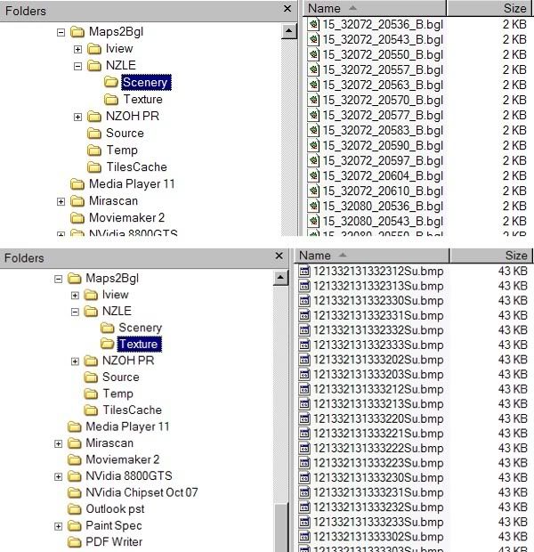
toprob wrote:QUOTE (toprob @ May 10 2008, 11:39 AM) <{POST_SNAPBACK}>I have never used Maps2BGL, but I do get a lot of queries about it, so I've done some study, and I even have a separate bookmark folder for it:) That way, I can just steer people to the appropriate place.
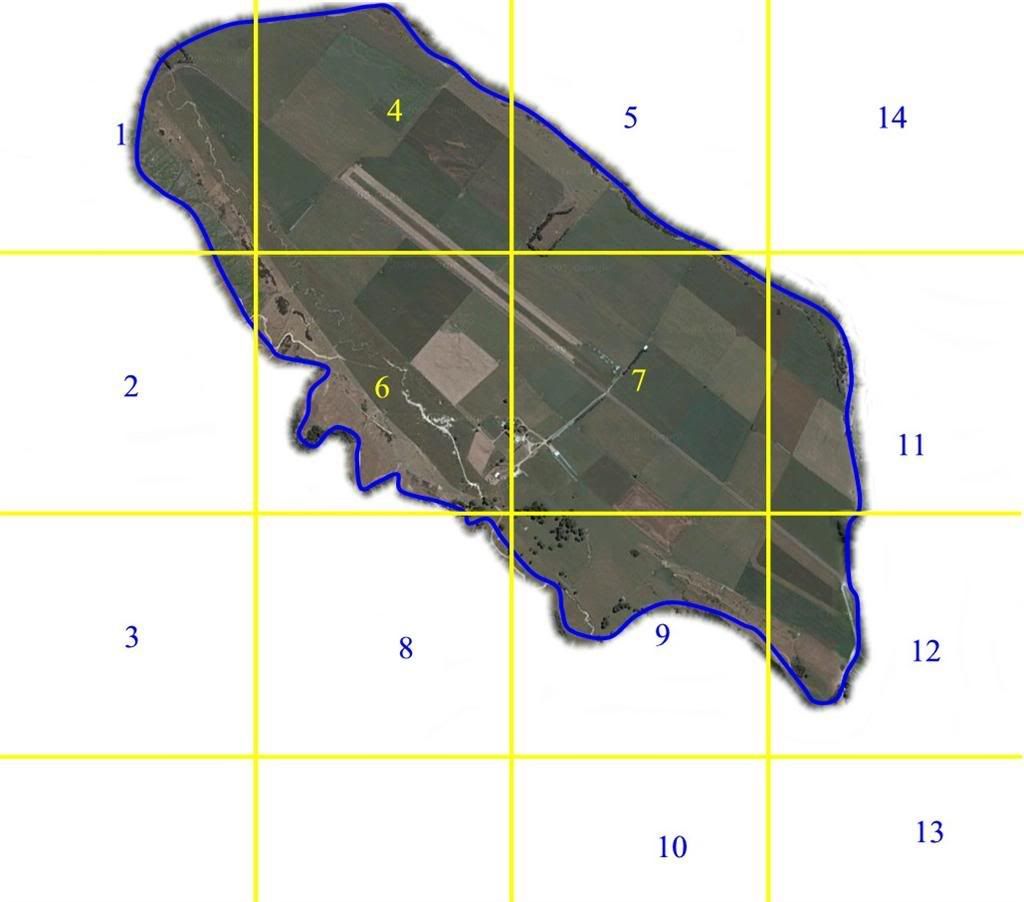
It seems that you can restrict the output to a particular area --take a look here.
Thanks for the link Robin, I missed something in initially selecting the smaller area, although I pretty well did what the manual says.
This is a very promising utility, for the limited kind of texture addons I want to do.creator2003 wrote:QUOTE (creator2003 @ May 10 2008, 12:44 PM) <{POST_SNAPBACK}>...What are you meaning, Google images into tiles?
I thought people were allowed to, as long as there is no profit?
And anyway, they are that changed with colors and masking, would it still matter then?...
You can't use any part of the original Google image as it is copyright.
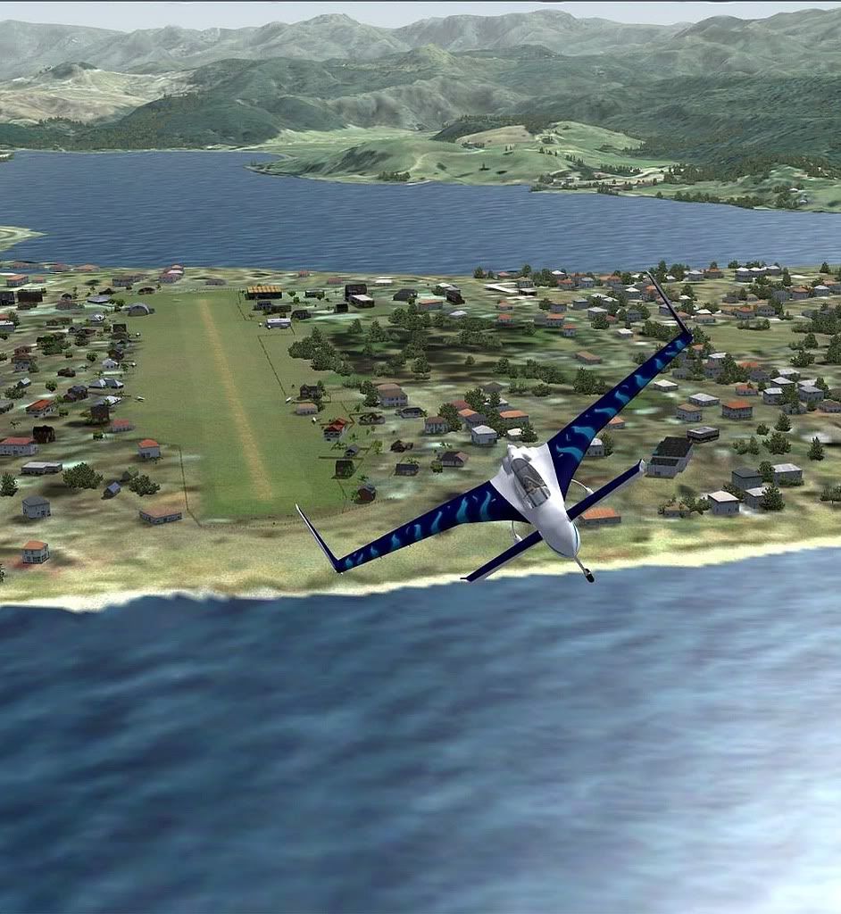
My intention is to use the Google image as a template, and create my own textures, much as I did with NZNE and Parakai.
Charl- NZFF Pro
- Topic author
- Joined: Mon May 01, 2006 8:28 am
- Posts: 9800
- Location: Auckland
![]() by toprob » Sat May 10, 2008 2:07 pm
by toprob » Sat May 10, 2008 2:07 pm
Charl wrote:QUOTE (Charl @ May 10 2008, 01:33 PM) <{POST_SNAPBACK}>You can't use any part of the original Google image as it is copyright.
My intention is to use the Google image as a template, and create my own textures, much as I did with NZNE and Parakai.
Yes, no matter what folk say about this, all the services, including Google, are very strict with their data. Many people try and interpret various bits to their benefit, but I wouldn't advise this:) Painting over it completely is acceptable, according to many, as long as none of the original image remains. Don't even try to apply 'artistic' copyright rules, regarding percentages of the original image, it won't work with Google.
Here's the relevant bit from Google Earth:QUOTE1. USE OF SOFTWARE
Subject to these Terms and Conditions, Google grants you a non-exclusive, non-transferable license to use the Software distributed with this Agreement during the term of this Agreement on a single designated computer. You may make one copy of the Software in machine-readable form for backup purposes only. The backup copy must include all copyright information contained on the original. Such license shall be, at Google's sole discretion, annual or monthly and is conditioned upon the receipt by Google or its authorized reseller of full payment for the Software but shall be terminable as provided in these Terms and Conditions. Your rights in the Software are limited to those expressly granted in this Section 1. Your rights in the Software do not cover any broadcast or media use without execution of a separate agreement with Google allowing you to do so. The geographical information made available for display using the Software is provided under a nonexclusive, non-transferable license for printing and use only by you. Any animations, movies, prints or screen outputs generated with the Software are for your use only. You may not use the Google Software in any manner that could damage, disable, overburden, or impair Google's services (e.g., you may not use the Google Software in an automated manner), nor may you use Software in any manner that could interfere with any other party's use and enjoyment of Google's services.[/quote]
They are quite specific about single-machine use, which many people have tried to re-interpret based on differing degree of silliness. And, really, you can't even use a tool like Map2BGL, as it represents an automated manner!Last edited by toprob on Sat May 10, 2008 2:09 pm, edited 1 time in total.
toprob- NZFF Pro
- Joined: Sat Apr 29, 2006 4:56 pm
- Posts: 6741
- Location: Upper Hutt
![]() by creator2003 » Sat May 10, 2008 4:10 pm
by creator2003 » Sat May 10, 2008 4:10 pm
![]() by greaneyr » Sat May 10, 2008 11:03 pm
by greaneyr » Sat May 10, 2008 11:03 pm

![]() by toprob » Sat May 10, 2008 11:29 pm
by toprob » Sat May 10, 2008 11:29 pm
greaneyr wrote:QUOTE (greaneyr @ May 10 2008, 11:03 PM) <{POST_SNAPBACK}>Probably going over old ground here, but where does google get their NZ imagery from? Saying aerial images come from google is like saying orange juice comes from a packet. Yes it does, but originally, it comes from oranges. The original imagery comes from various regional councils. The reason Google have to be protective of the data will be to do with the terms under which they have been granted permission to use the imagery supplied by the thousands of sources worldwide.
If we could cut to the chase and go straight to the source (eg the councils) we may have more joy.
There's a lot to that, the main reason why Google is quite protective of its imagery is that it must have hundreds of different licence agreements to maintain. As you move around in Google Earth, you may get an idea of who owns the local imagery -- for instance, zoom in on NZAA and it shows as 'Copyright Auckland International Airport.'
The aerial I used for Paraparaumu came directly from the Kapiti Council, and I did need to sign an agreement to use it. Most councils would be willing to consider this, if they own their own imagery, but some have limited license agreements which may make this difficult. You can only ask. If they have a viewable GIS system online, they may be easier to approach, as they would already have the basis of third party licensing in place, and understand the implications of using the digital imagery.
The only problem I have is that most councils who own their own imagery have an implied agreement with their rate payers that it will only be paid for once -- and me selling it in the form of flightsim scenery may constitute selling it twice to the locals:) That's one of the reasons why Paraparaumu is freeware. The main reason why I don't yet have permission to use much of the local council imagery from throughout the country is that it isn't gonna make me any money, so the freeware developers may as well have it.
By the way, the Ardmore scenery doesn't appear to be based on Google imagery -- although it could just as easily be any of the online map sources. The scenery author doesn't mention the source, but just because he used SBuilder to obtain it, it doesn't mean that he didn't obtain permission to release it.
![]() by Christian » Mon May 12, 2008 2:47 pm
by Christian » Mon May 12, 2008 2:47 pm

![]() by Charl » Mon Jun 02, 2008 7:58 pm
by Charl » Mon Jun 02, 2008 7:58 pm

![]() by Ian Warren » Mon Jun 02, 2008 9:32 pm
by Ian Warren » Mon Jun 02, 2008 9:32 pm


![]() by creator2003 » Mon Jun 02, 2008 11:49 pm
by creator2003 » Mon Jun 02, 2008 11:49 pm

![]() by Timmo » Sat Jun 07, 2008 1:40 pm
by Timmo » Sat Jun 07, 2008 1:40 pm

![]() by Ian Warren » Sat Jun 07, 2008 1:54 pm
by Ian Warren » Sat Jun 07, 2008 1:54 pm
 to the aircrew , their MOTTO JUST DO IT
![]() by Charl » Sat Jun 07, 2008 5:30 pm
by Charl » Sat Jun 07, 2008 5:30 pm
Timmo wrote:QUOTE (Timmo @ Jun 7 2008, 01:40 PM) <{POST_SNAPBACK}>What you are doing Charl is a bit different though....
Yes I'm not infringing any copyright in creating (as opposed to copying from elsewhere) replacement textures.
Still it just seems like good manners to ask before you barge in on someone else's work.Last edited by Charl on Sat Jun 07, 2008 5:31 pm, edited 1 time in total.
![]() by creator2003 » Sat Jun 07, 2008 6:32 pm
by creator2003 » Sat Jun 07, 2008 6:32 pm
![]() by Christian » Fri Jun 13, 2008 3:05 pm
by Christian » Fri Jun 13, 2008 3:05 pm
![]() by creator2003 » Fri Jun 13, 2008 9:01 pm
by creator2003 » Fri Jun 13, 2008 9:01 pm
![]() by Timmo » Tue Jun 17, 2008 12:18 pm
by Timmo » Tue Jun 17, 2008 12:18 pm
Users browsing this forum: No registered users and 23 guests