VNCs and Enroute Charts Available
2 posts
• Page 1 of 1
![]() by benwynn » Thu May 10, 2012 1:38 pm
by benwynn » Thu May 10, 2012 1:38 pm
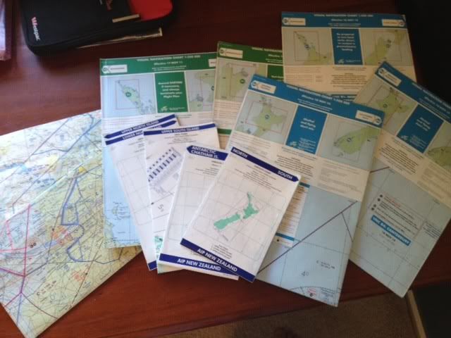
I have lying around a few old real world charts which may be of some use or interest to a flight sim pilot. VNCs (both 1:250 and 1:500) for areas scattered around the South and North Islands that have all expired, and a full set of IFR Enroute charts covering New Zealand which are up to date until the end of May 2012.
-

benwynn - Senior Member
- Topic author
- Joined: Wed Apr 11, 2007 9:11 pm
- Posts: 1433
- Location: YBBN
![]() by Adamski » Thu May 10, 2012 2:04 pm
by Adamski » Thu May 10, 2012 2:04 pm
benwynn wrote:QUOTE (benwynn @ May 10 2012,1:38 PM) <{POST_SNAPBACK}>I have lying around a few old real world charts which may be of some use or interest to a flight sim pilot. VNCs (both 1:250 and 1:500) for areas scattered around the South and North Islands that have all expired, and a full set of IFR Enroute charts covering New Zealand which are up to date until the end of May 2012.
I'd be interested in those! Cost? Donation? PM sent ...

-

Adamski - NZFF Pro
- Joined: Thu Nov 01, 2007 2:22 am
- Posts: 5047
- Location: Birkenhead, Auckland
2 posts
• Page 1 of 1
Who is online
Users browsing this forum: No registered users and 7 guests